Accept
By using FCCInfo you agree to the terms & conditions. Read disclaimer Read privacy statement
FCCInfo.com

A Service of Cavell, Mertz & Associates, Inc.
(855) FCC-INFO

WKTO(FM)
Call Sign History
WKTO from 02/26/1993
88.9 MHz

Edgewater, FL
License
CP
Application
Allocation
STA


WKTO Channel: 205C2 88.9 MHz
Edgewater, Florida
Service: FS - A full service FM station auxiliary transmitting antenna or application.
Facility ID: 42684
FRN: 0001801844
Fac. Service: FM

Status: CP
Application Accepted: 11/09/2020
Application Granted: 12/30/2020
File Number: 0000124973
WKTO CP Expires: 12/30/2023
Application Type: Minor Amendment

FCC Website Links:
  LMS Facility Details
  This Application
  Other WKTO Applications
  Other WKTO Applications in CDBS
  Including Superseded Applications
  Mailing Address
  Correspondence for WKTO
  Correspondence related to application 0000124973
  Service Contour - Open Street Map or USGS Map (60 dBu)
  Service Contour - KML / Google Earth (60 dBu)
  Public Inspection Files

Facility Type: NON-COMMERCIAL EDUC. FM
Class: C2, A Zone II station; with 25kW-50kW ERP and a class contour distance 39km-52km

Site Location: 29-01-30.9 N 81-08-51.4 W (NAD 83)
Site Location: 29-01-30.0 N 81-08-52.2 W (Converted to NAD 27)

Effective Radiated Power: 0 kW Horiz. ; 14.5 kW Vert.
Antenna Center HAAT: 0 m Horiz.; 89 m Vert.
Antenna Center AMSL: 0 m Horiz.; 99.2 m Vert.
Antenna Center HAG: 0 m Horiz.; 87 m Vert.

Site Elevation: 12.2 m. (40 ft.)
Height Overall*: 124.7 m (409 ft.)
(* As Filed In This Application, may differ from ASR Data, Below.)
Omni-Directional Antenna
Antenna Make/Model: None
Antenna ID: 1006063
Polarization:

Associated Facilities
W238AM (FX) Titusville, Florida
Structure Information

Structure Registration Number 1254100

Structure Type: TOWER
Registered To:
Mims Community Radio, Inc.
Structure Address:
1 Mile West Of Intersection Of Pioneer Trail And Sr 44, On Sr 44
Deland, FL
County Name: Volusia County
ASR Issued: 06/28/2006
Date Built: 04/04/2011
Site Elevation: 12.2 m (40 ft.)
Structure Height: 124 m (407 ft.)
Height Overall: 124.7 m (409 ft.)
Overall Height AMSL: 136.9 m (449 ft.)
FAA Determination: 06/19/2006
FAA Study #: 2006-ASO-3069-OE
FAA Circular #: 70/7460-1K
Paint & Light FAA Chapters: 4, 6, 12
Removed expiration date from determination. Scenario 1./jjs/case#635066
29-01-30.9 N 81-08-51.4 W (NAD 83)
29-01-30.0 N 81-08-52.2 W
(Converted to NAD 27)
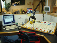
WKTO(FM) Licensee Information

Mims Community Radio, Inc.
900 Old Mission Road
New Smyrna Beach, FL 32168
Phone: 386-427-1095
Not-for-Profit
0000124973 Applicant Information

Carol Henry
Title: President
Date: 11/09/2020
Application Certifier
Mims Community Radio, Inc.
900 Old Mission Road
New Smyrna Beach, FL 32168
Applicant
Randy Henry
Florida Public Radio, Inc.
505 Josephine St
Titusville, FL 32796
Tech Dir
Associated Land Mobile Licenses


 WPXA859 Broadcast Auxiliary Remote Pickup
 WPXC954 Broadcast Auxiliary Remote Pickup
Associated Microwave Licenses


 WMU829 950 MHz Aural Studio Transmitter Link

Study Date: 9/29/2024; Study Duration: 0.038 Seconds.
Database Sources:
09/27/2024 FCC LMS,
9/24/2024 FCC ASR,
9/24/2024 FCC ULS Microwave, and
9/24/2024 FCC ULS Broadcast Land Mobile.


© 2024Capitol Airspace Group, LLC.
Alexandria, Virginia


If you have questions or concerns about the station above please contact the station Licensee.
Comments and questions about FCCInfo can be emailed to: webmaster@fccinfo.com