
FCCInfo.com
A Service of Cavell, Mertz & Associates, Inc.
(855) FCC-INFO
|
|
W254DB from 11/15/2016 W254DB from 09/23/2004 |
|
|
||||||||||||||||
|
|
W254DB Channel: 254D 98.7 MHz Chattanooga, Tennessee Service: FX - A translator or application for a translator. Facility ID: 156865 Fac. Service: FX Programming Delivery Method: Unspecified Status: License Application Accepted: 12/10/2018 Application Granted: 12/19/2018 File Number: BLFT-20181210AAR License Expires: 00/00/0000 Prefix Type: This is a license for a translator Application Type: License To Cover FCC Website Links: LMS Facility Details This Application CDBS Application Other W254DB Applications Other W254DB Applications in CDBS Including Superseded Applications Mailing Address Correspondence for W254DB Correspondence related to application BLFT-20181210AAR Service Contour - Open Street Map or USGS Map (60 dBu) Service Contour - KML / Google Earth (60 dBu) Class: D, A Noncommercial educational operating with no more than 10W Site Location: 35-07-45.2 N 85-20-01.7 W (NAD 83) Site Location: 35-07-44.9 N 85-20-01.8 W (Converted to NAD 27) Effective Radiated Power: 0.099 kW Transmitter Output Power: 0.052 kW Antenna Center HAAT: 0 m Antenna Center AMSL: 674 m (2211 ft.) Antenna Center HAG: 100 m (328 ft.) Site Elevation: 574 m. (1883 ft.) Height Overall*: 113 m (371 ft.) (* As Filed In This Application, may differ from ASR Data, Below.) Directional Antenna Antenna Make/Model: None Antenna ID: 133806 Polarization:
| ||||||||||||||||||
| Antenna Data for Antenna Id: 133806 W254DB FX File: BLFT-20181210AAR None - Service: FX | 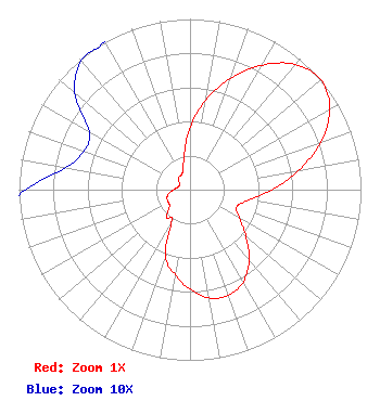 | ||||||||||||||||||
| Azimuth | Ratio | Azimuth | Ratio | Azimuth | Ratio | Azimuth | Ratio | ||||||||||||
| 0 | 0.368 | 10 | 0.535 | 20 | 0.695 | 30 | 0.843 | ||||||||||||
| 40 | 0.957 | 50 | 1.000 | 60 | 0.944 | 70 | 0.814 | ||||||||||||
| 80 | 0.643 | 90 | 0.480 | 100 | 0.350 | 110 | 0.291 | ||||||||||||
| 120 | 0.334 | 130 | 0.427 | 140 | 0.538 | 150 | 0.624 | ||||||||||||
| 160 | 0.660 | 170 | 0.644 | 180 | 0.583 | 190 | 0.506 | ||||||||||||
| 200 | 0.418 | 210 | 0.211 | 220 | 0.211 | 230 | 0.157 | ||||||||||||
| 240 | 0.146 | 250 | 0.143 | 260 | 0.126 | 270 | 0.096 | ||||||||||||
| 280 | 0.074 | 290 | 0.066 | 300 | 0.068 | 310 | 0.088 | ||||||||||||
| 320 | 0.099 | 330 | 0.101 | 340 | 0.123 | 350 | 0.200 | ||||||||||||
Structure Registration Number 1052960 Structure Type: TOWER Registered To: American Towers LLC Structure Address: 574.2us Hwy 127 .5m N Of Signal Mtn (088747 / Signal Mountain) Signal Mountian, TN County Name: Hamilton County ASR Issued: 06/01/2022 Date Built: 10/25/1953 Site Elevation: 574.2 m (1884 ft.) Structure Height: 103.6 m (340 ft.) Height Overall: 112.8 m (370 ft.) Overall Height AMSL: 687 m (2254 ft.) FAA Determination: 03/02/2010 FAA Study #: 2010-ASO-472-OE FAA Circular #: 70/7460-1J Paint & Light FAA Chapters: 4, 5, 6, 8, 13 PRIOR STUDY 2005-ASO-2534-OE 35-07-45.2 N 85-20-01.7 W (NAD 83) 35-07-44.9 N 85-20-01.8 W (Converted to NAD 27) |
C/o Beverly B. Poston One Television Place Charlotte, NC 28205 Phone: 704-372-4434 | Date: 12/10/2018 Application Certifier JACKSON TELECASTERS, INC. C/o Beverly Poston One Television Place Charlotte, NC 28205 Applicant CARL E GLUCK Carl T Jones Corp 7901 Yarnwood Court Springfield, VA 22153-2899 TECHNICAL CONSULTANT M. ANNE SWANSON Wilkinson Barker Knauer 1800 M Street Nw Suite 800n Washington, DC 20036 | |||||||||||||||||