|
|
Antenna Structure Registration 1053809 |
 |
Registration Info | Registration Number: 1053809 |
| File Number: A1264602 |
| FAA Study: 2016-AGL-9490-OE |
| FAA Issue Date: 07/07/2016 |
| Status: Constructed |
| Date Constructed: 08/08/1997 |
| NEPA: N |
Structure Info
| Structure Type: GTOWER |
| Structure Coordinates: 46-20-55.0 N 94-13-28.9 W (NAD 83) |
| Structure Coordinates: 46-20-55.1 N 94-13-27.9 W (Converted to NAD 27) |
| Structure Address: 8330 Highland Scenic Dr |
| Structure City: Baxter, MN |
| Structure County: Crow Wing County |
| Painting & Lighting Info |
FAA Circular #: 70/7460-1L |
FAA Chapters: 4, 8, 12 |
Remarks: PRIOR STUDY 2016-AGL-5538-OE |
| Elevation Info |
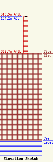
Site Elevation: 362.7 meters (1190 ft) |
| Height of Structure: 152.4 meters (500 feet) |
| Overall Height Above Ground: 154.2 meters (506 feet) |
| Overall Height Above Mean Sea Level: 516.9 meters (1696 feet) |
| Owner Info | EIP Holdings II, LLC
2 ALLEGHENY CTR STE 1002
PITTSBURGH, PA 15212
(844) 282-7748
regulatory@everestinfrastructure.com |
| Contact Info | EIP Holdings II, LLC
2 ALLEGHENY CTR STE 1002
PITTSBURGH, PA 15212
Justin Burgess
(844) 282-7748
regulatory@everestinfrastructure.com |
