|
|
Antenna Structure Registration 1243832 |
 |
Registration Info | Registration Number: 1243832 |
| File Number: A0875951 |
| FAA Study: 2013-AWP-1667-OE |
| FAA Issue Date: 03/28/2013 |
| Status: Constructed |
| Date Constructed: 12/07/2013 |
| FAA EMI: N |
| NEPA: N |
Structure Info
| Structure Type: LTOWER |
| Structure Coordinates: 34-9-10.9 N 116-23-23.3 W (NAD 83) |
| Structure Coordinates: 34-09-10.9 N 116-23-20.3 W (Converted to NAD 27) |
| Structure Address: End Of Serin Dr. On Paxton Pk. |
| Structure City: Yucca Valley, CA |
| Structure County: San Bernardino County |
| Painting & Lighting Info |
FAA Chapters: NONE |
Remarks: PRIOR STUDY 2005-AWP-6434-OE |
| Elevation Info |
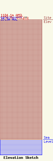
Site Elevation: 1158.8 meters (3802 ft) |
| Height of Structure: 24.4 meters (80 feet) |
| Overall Height Above Ground: 25.3 meters (83 feet) |
| Overall Height Above Mean Sea Level: 1184.1 meters (3885 feet) |
| Info |
| Info |
