|
|
Antenna Structure Registration 1018930 |
 |
Registration Info | Registration Number: 1018930 |
| File Number: A0905803 |
| FAA Study: 2007-AWP-2742-OE |
| FAA Issue Date: 05/22/2007 |
| Status: Granted |
| Date Constructed: 05/22/2007 |
| NEPA: N |
Structure Info
| Structure Type: LTOWER |
| Structure Coordinates: 40-7-12.4 N 123-41-35.2 W (NAD 83) |
| Structure Coordinates: 40-07-12.9 N 123-41-31.1 W (Converted to NAD 27) |
| Structure Address: Alder Pt Rd Peak Pratt Mountain 8.53 Km E 2.25 Km N Of |
| Structure City: Garberville, CA |
| Structure County: Humboldt County |
| Painting & Lighting Info |
FAA Circular #: 70/7460-1K |
FAA Chapters: 3, 4, 5, 12 |
Remarks: PRIOR STUDY 2006-AWP-5776-OE |
Remarks: OM&L to remain the same as prior study = PAINT/RED LIGHTS |
Remarks: PRIOR STUDY 2006-AWP-5776-OE |
Remarks: OM&L to remain the same as prior study = PAINT/RED LIGHTS |
| Elevation Info |
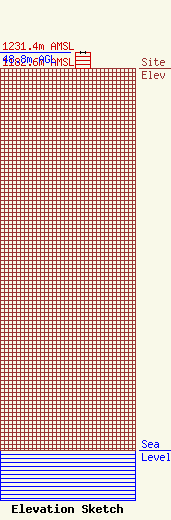
Site Elevation: 1182.6 meters (3880 ft) |
| Height of Structure: 48.8 meters (160 feet) |
| Overall Height Above Ground: 48.8 meters (160 feet) |
| Overall Height Above Mean Sea Level: 1231.4 meters (4040 feet) |
| Info |
| Info |
