|
|
Antenna Structure Registration 1261371 |
 |
Registration Info | Registration Number: 1261371 |
| File Number: A1280937 |
| FAA Study: 2007-ACE-2001-OE |
| FAA Issue Date: 09/11/2007 |
| Status: Constructed |
| Date Constructed: 01/14/2008 |
| FAA EMI: N |
| NEPA: N |
Structure Info
|
| Structure Coordinates: 37-10-39.6 N 101-20-48.3 W (NAD 83) |
| Structure Coordinates: 37-10-39.5 N 101-20-46.7 W (Converted to NAD 27) |
| Structure Address: 114 E. 6th Street |
| Structure City: Hugoton, KS |
| Structure County: Stevens County |
| Painting & Lighting Info |
FAA Chapters: NONE |
Remarks: Removed expiration date from determination. Scenario 1./jjs/case#635066 |
| Elevation Info |
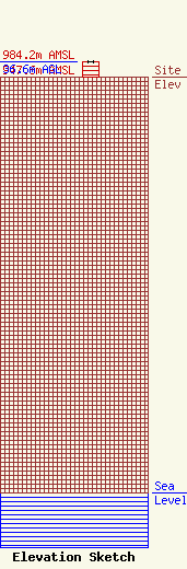
Site Elevation: 947.6 meters (3109 ft) |
| Height of Structure: 36.6 meters (120 feet) |
| Overall Height Above Ground: 36.6 meters (120 feet) |
| Overall Height Above Mean Sea Level: 984.2 meters (3229 feet) |
| Owner Info | The Pioneer Telephone Association, Inc. d/b/a Pioneer Communications
120 West Kansas Avenue
707
Ulysses, KS 67880
(620) 356-3211
gavin.fowler@pioncomm.net |
| Contact Info | Anthony Veach Law PLLC
1575 Birdie Way
Lawrence, KS 66047
Anthony Veach
(202) 631-9190
anthonyveach@anthonyveachlaw.com |
