|
|
Antenna Structure Registration 1063022 |
 |
Registration Info | Registration Number: 1063022 |
| File Number: A1249113 |
| FAA Study: 2022-ASW-15184-OE |
| FAA Issue Date: 11/18/2022 |
| Status: Constructed |
| Date Constructed: 02/02/1976 |
Structure Info
| Structure Type: GTOWER |
| Structure Coordinates: 35-54-32.1 N 108-46-27.6 W (NAD 83) |
| Structure Coordinates: 35-54-32.1 N 108-46-25.3 W (Converted to NAD 27) |
| Structure Address: 3.5 Miles Nw Of Tohatchi |
| Structure City: Deza Bluff, NM |
| Structure County: McKinley County |
| Painting & Lighting Info |
FAA Circular #: 70/7460-1M |
FAA Chapters: 4, 8, 15 |
Remarks: PRIOR STUDY 2020-ASW-14898-OE |
| Elevation Info |
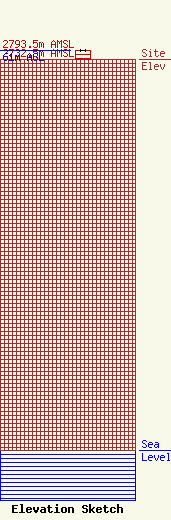
Site Elevation: 2732.5 meters (8965 ft) |
| Height of Structure: 61 meters (200 feet) |
| Overall Height Above Ground: 61 meters (200 feet) |
| Overall Height Above Mean Sea Level: 2793.5 meters (9165 feet) |
| Owner Info | Navajo Communications Company, Inc.
11 S. Madison Ave.
Cookeville, TN 38501
(931) 528-1584
elissa.mcomber@ftr.com |
| Contact Info | Frontier Communications
11 S. Madison Ave.
Cookeville, TN 38501
Elissa McOmber
(931) 528-1584
elissa.mcomber@ftr.com |
