|
|
Antenna Structure Registration 1049603 |
 |
Registration Info | Registration Number: 1049603 |
| File Number: A0972197 |
| FAA Study: 2015-AWP-4600-OE |
| FAA Issue Date: 05/07/2015 |
| Status: Constructed |
| Date Constructed: 08/28/2001 |
| NEPA: N |
Structure Info
| Structure Type: GTOWER |
| Structure Coordinates: 37-19-21.8 N 121-45-18.7 W (NAD 83) |
| Structure Coordinates: 37-19-22.0 N 121-45-14.9 W (Converted to NAD 27) |
| Structure Address: 3903 Aborn Rd (#269318) |
| Structure City: San Jose, CA |
| Structure County: Santa Clara County |
| Painting & Lighting Info |
FAA Chapters: NONE |
Remarks: PRIOR STUDY 2012-AWP-2454-OE |
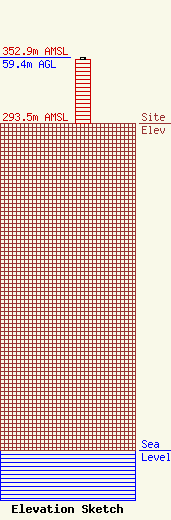
| Elevation Info |
Site Elevation: 293.5 meters (963 ft) |
| Height of Structure: 57.9 meters (190 feet) |
| Overall Height Above Ground: 59.4 meters (195 feet) |
| Overall Height Above Mean Sea Level: 352.9 meters (1158 feet) |
| Owner Info | American Towers LLC
10 Presidential Way
Woburn, MA 01801
(678) 564-3236
faa-fcc@americantower.com |
| Contact Info | American Towers, LLC.
10 Presidential Way
Woburn, MA 01801
(678) 564-3236
faa-fcc@americantower.com |
