|
|
Antenna Structure Registration 1059085 |
 |
Registration Info | Registration Number: 1059085 |
| File Number: A0994700 |
| Status: Constructed |
| Date Constructed: 01/01/1989 |
| FAA EMI: N |
| NEPA: N |
Structure Info
| Structure Type: TOWER |
| Structure Coordinates: 39-22-4.0 N 119-47-11.0 W (NAD 83) |
| Structure Coordinates: 39-22-04.3 N 119-47-07.3 W (Converted to NAD 27) |
| Structure Address: Steamboat Hill 5.7 Km Nne |
| Structure City: Washoe City, NV |
| Structure County: Washoe County |
| Painting & Lighting Info |
FCC Paragraph(s): None |
| Elevation Info |
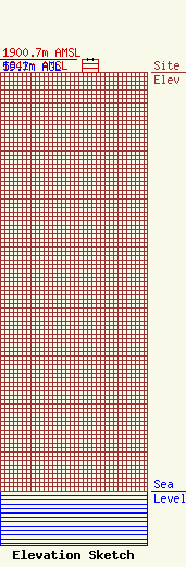
Site Elevation: 1841 meters (6040 ft) |
| Height of Structure: 59.7 meters (196 feet) |
| Overall Height Above Ground: 59.7 meters (196 feet) |
| Overall Height Above Mean Sea Level: 1900.7 meters (6236 feet) |
| Owner Info | CTI Towers Assets II, LLC
38 Pond St.
Franklin, MA 02038
(508) 440-5780
Lstearns@ctitowers.com |
| Contact Info | CTI Towers Assets II, LLC
38 Pond St.
Franklin, MA 02038
Carrie Larson
(508) 440-5780
Lstearns@ctitowers.com |
