|
|
Antenna Structure Registration 1001685 |
 |
Registration Info | Registration Number: 1001685 |
| File Number: A1035547 |
| FAA Study: 2016-ANM-997-OE |
| FAA Issue Date: 05/12/2016 |
| Status: Constructed |
| Date Constructed: 08/01/1993 |
| NEPA: N |
Structure Info
| Structure Type: GTOWER |
| Structure Coordinates: 46-48-31.4 N 113-58-41.6 W (NAD 83) |
| Structure Coordinates: 46-48-31.7 N 113-58-38.2 W (Converted to NAD 27) |
| Structure Address: Stone Mountain |
| Structure City: Missoula, MT |
| Structure County: Missoula County |
| Painting & Lighting Info |
FAA Circular #: 70/7460-1H |
FAA Chapters: 3, 4, 5, 13 |
Remarks: PRIOR STUDY 1992-ANM-750-OE |
Remarks: OM&L to remain the same as prior study = PAINT/RED LIGHTS |
Remarks: PRIOR STUDY 1992-ANM-750-OE |
Remarks: OM&L to remain the same as prior study = PAINT/RED LIGHTS |
| Elevation Info |
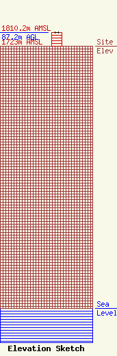
Site Elevation: 1723 meters (5653 ft) |
| Height of Structure: 87.2 meters (286 feet) |
| Overall Height Above Ground: 87.2 meters (286 feet) |
| Overall Height Above Mean Sea Level: 1810.2 meters (5939 feet) |
| Owner Info | SHEILA CALLAHAN And FRIENDS INC DBA KMSO RADIO
309
MISSOULA, MT 59806
(406) 542-1025
THEPOINT@MARSWEB.COM |
| Contact Info | SHEILA CALLAHAN And FRIENDS INC DBA KMSO RADIO
P. O. Box
5421025
Missoula, MT 59806
Max Murphy
(406) 542-1025
Max@MTNBDC.com |
