|
|
Antenna Structure Registration 1005291 |
 |
Registration Info | Registration Number: 1005291 |
| File Number: A1341826 |
| FAA Study: 2014-AGL-10836-OE |
| FAA Issue Date: 10/14/2014 |
| Status: Constructed |
| Date Constructed: 01/01/1976 |
| NEPA: N |
Structure Info
| Structure Type: GTOWER |
| Structure Coordinates: 43-23-2.8 N 86-19-31.1 W (NAD 83) |
| Structure Coordinates: 43-23-02.8 N 86-19-30.9 W (Converted to NAD 27) |
| Structure Address: 6956 Blank Rd |
| Structure City: Whitehall, MI |
| Structure County: Muskegon County |
| Painting & Lighting Info |
FCC Paragraph(s): 1, 3, 12, 21 |
Remarks: Continue As Is OM&L = PAINT/RED LIGHTS |
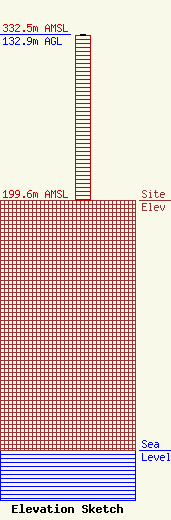
| Elevation Info |
Site Elevation: 199.6 meters (655 ft) |
| Height of Structure: 132 meters (433 feet) |
| Overall Height Above Ground: 132.9 meters (436 feet) |
| Overall Height Above Mean Sea Level: 332.5 meters (1091 feet) |
| Owner Info | VB Nimbus, LLC
22 W Atlantic Avenue
Delray Beach, FL 33444
(561) 406-4015
fcc-faa@verticalbridge.com |
| Contact Info | VB Nimbus, LLC
22 W Atlantic Avenue
Delray Beach, FL 33444
Richard Hickey
(561) 406-4015
fcc-faa@verticalbridge.com |
