|
|
Antenna Structure Registration 1006934 |
 |
Registration Info | Registration Number: 1006934 |
| File Number: A1351651 |
| FAA Study: 97-ASO-1507-OE |
| FAA Issue Date: 05/22/1997 |
| Status: Constructed |
| Date Constructed: 01/01/1986 |
| FAA EMI: N |
| NEPA: N |
Structure Info
| Structure Type: TOWER |
| Structure Coordinates: 34-29-42.0 N 77-29-18.0 W (NAD 83) |
| Structure Coordinates: 34-29-41.4 N 77-29-19.1 W (Converted to NAD 27) |
| Structure Address: .9 Km W Of Thomas Landing Rd |
| Structure City: Jacksonville, NC |
| Structure County: Onslow County |
| Painting & Lighting Info |
FAA Circular #: 70/7460-1J |
FAA Chapters: 3, 4, 5, 13 |
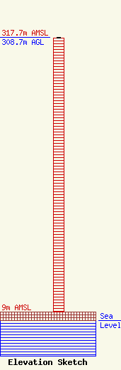
| Elevation Info |
Site Elevation: 9 meters (30 ft) |
| Height of Structure: 308 meters (1010 feet) |
| Overall Height Above Ground: 308.7 meters (1013 feet) |
| Overall Height Above Mean Sea Level: 317.7 meters (1042 feet) |
| Owner Info | TowerCo VI, LLC
5000 Valleystone Dr
Cary, NC 27519
(919) 653-5700
hbyrne@towerco.com |
| Contact Info | TowerCo VI, LLC
5000 Valleystone Dr
Cary, NC 27519
Henry Byrne
(919) 653-5700
hbyrne@towerco.com |
