|
|
Antenna Structure Registration 1017257 |
 |
Registration Info | Registration Number: 1017257 |
| File Number: A1071106 |
| FAA Study: 2017-ACE-2139-OE |
| FAA Issue Date: 04/21/2017 |
| Status: Constructed |
| Date Constructed: 04/25/2017 |
| NEPA: N |
Structure Info
| Structure Type: GTOWER |
| Structure Coordinates: 41-26-7.0 N 94-50-1.0 W (NAD 83) |
| Structure Coordinates: 41-26-07.0 N 94-50-00.1 W (Converted to NAD 27) |
| Structure Address: 5.8 Km Wsw |
| Structure City: Anita, IA |
| Structure County: Cass County |
| Painting & Lighting Info |
FAA Circular #: 70/7460-1L |
FAA Chapters: 3, 4, 5, 12 |
Remarks: PRIOR STUDY 1992-ACE-733-OE |
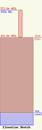
| Elevation Info |
Site Elevation: 420.6 meters (1380 ft) |
| Height of Structure: 152 meters (499 feet) |
| Overall Height Above Ground: 152 meters (499 feet) |
| Overall Height Above Mean Sea Level: 572.6 meters (1879 feet) |
| Owner Info | MEREDITH COMMUNICATIONS LLC
413 Chestnut Street
Atlantic, IA 50022
(712) 243-6885
mrbillstewart@hotmail.com |
| Contact Info | MEREDITH COMMUNICATIONS LLC
413 Chestnut Street
Atlantic, IA 50022
WILLIAM SALUK
(712) 243-6885
mrbillstewart@hotmail.com |
