|
|
Antenna Structure Registration 1019738 |
 |
Registration Info | Registration Number: 1019738 |
| File Number: A1341881 |
| FAA Study: 2021-ASW-13986-OE |
| FAA Issue Date: 09/16/2021 |
| Status: Granted |
| Date Constructed: 01/01/1987 |
| NEPA: N |
Structure Info
| Structure Type: GTOWER |
| Structure Coordinates: 30-37-23.7 N 91-9-49.6 W (NAD 83) |
| Structure Coordinates: 30-37-23.0 N 91-09-49.2 W (Converted to NAD 27) |
| Structure Address: .1 Mi W Of Highway 19 S (us-la-5098) |
| Structure City: Zachary, LA |
| Structure County: East Baton Rouge Parish |
| Painting & Lighting Info |
FAA Circular #: 70/7460-1M |
FAA Chapters: 4, 8, 15 |
Remarks: PRIOR STUDY 2004-ASW-4236-OE |
| Elevation Info |
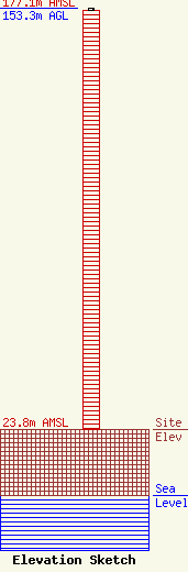
Site Elevation: 23.8 meters (78 ft) |
| Height of Structure: 152.4 meters (500 feet) |
| Overall Height Above Ground: 153.3 meters (503 feet) |
| Overall Height Above Mean Sea Level: 177.1 meters (581 feet) |
| Owner Info | VB Nimbus, LLC
22 W Atlantic Avenue
Delray Beach, FL 33444
(561) 406-4015
fcc-faa@verticalbridge.com |
| Contact Info | VB Nimbus, LLC
22 W Atlantic Avenue
Delray Beach, FL 33444
Richard Hickey
(561) 406-4015
fcc-faa@verticalbridge.com |
