|
|
Antenna Structure Registration 1033623 |
 |
Registration Info | Registration Number: 1033623 |
| File Number: A1213657 |
| FAA Study: N/A |
| Status: Constructed |
| Date Constructed: 07/03/1998 |
| FAA EMI: N |
| NEPA: N |
Structure Info
|
| Structure Coordinates: 38-21-34.0 N 80-38-50.0 W (NAD 83) |
| Structure Coordinates: 38-21-33.6 N 80-38-50.7 W (Converted to NAD 27) |
| Structure Address: 11,000 Ft N Of St Rt 150 & 20 |
| Structure City: Craigsville, WV |
| Structure County: Nicholas County |
| Painting & Lighting Info |
FCC Paragraph(s): None |
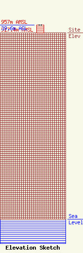
| Elevation Info |
Site Elevation: 917.4 meters (3010 ft) |
| Height of Structure: 39.6 meters (130 feet) |
| Overall Height Above Ground: 39.6 meters (130 feet) |
| Overall Height Above Mean Sea Level: 957 meters (3140 feet) |
| Owner Info | LLoyd Hoff Holding Corp.
166 Jack Burlingame Dr.
Millwood, WV 25262
(130) 427-3279
support@lloydselectronics.com |
| Info |
