|
|
Antenna Structure Registration 1036853 |
 |
Registration Info | Registration Number: 1036853 |
| File Number: A0727379 |
| Status: Constructed |
| Date Constructed: 01/01/1958 |
| FAA EMI: N |
| NEPA: N |
Structure Info
| Structure Type: 3TA2 |
| Structure Coordinates: 39-30-40.0 N 76-11-35.0 W (NAD 83) |
| Structure Coordinates: 39-30-39.6 N 76-11-36.2 W (Converted to NAD 27) |
| Structure Address: Twr 2 400 Hiob Ln .1 Mi W |
| Structure City: Aberdeen, MD |
| Structure County: Harford County |
| Painting & Lighting Info |
FCC Paragraph(s): 1, 3, 11, 21 |
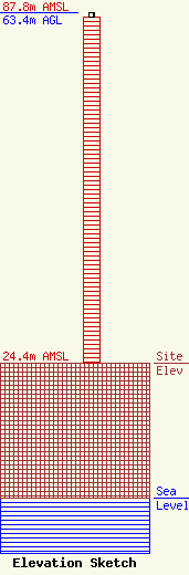
| Elevation Info |
Site Elevation: 24.4 meters (80 ft) |
| Height of Structure: 62.5 meters (205 feet) |
| Overall Height Above Ground: 63.4 meters (208 feet) |
| Overall Height Above Mean Sea Level: 87.8 meters (288 feet) |
| Owner Info | RADIO BROADCAST COMMUNICATIONS INC
13321 NEW HAMPSHIRE AVE SUITE 207
SILVER SPRING, MD 20904
(301) 424-9292
Rbcstudios@aol.com |
| Contact Info | RADIO BROADCAST COMMUNICATIONS INC
13321 NEW HAMPSHIRE AVE SUITE 207
SILVER SPRING, MD 20904
BILL PARRIS
(301) 424-9292
RBCSTUDIOS@AOL.COM |
