|
|
Antenna Structure Registration 1038699 |
 |
Registration Info | Registration Number: 1038699 |
| File Number: A1214450 |
| FAA Study: 98-AGL-1015-OE |
| FAA Issue Date: 05/06/1998 |
| Status: Constructed |
| Date Constructed: 01/01/1990 |
| FAA EMI: N |
| NEPA: N |
Structure Info
| Structure Type: GTOWER |
| Structure Coordinates: 48-14-20.0 N 103-39-6.0 W (NAD 83) |
| Structure Coordinates: 48-14-19.9 N 103-39-04.3 W (Converted to NAD 27) |
| Structure Address: 7.5 Km N (twr 3) |
| Structure City: Williston, ND |
| Structure County: Williams County |
| Painting & Lighting Info |
FAA Chapters: NONE |
| Elevation Info |
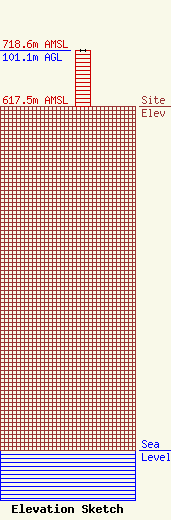
Site Elevation: 617.5 meters (2026 ft) |
| Height of Structure: 101.1 meters (332 feet) |
| Overall Height Above Ground: 101.1 meters (332 feet) |
| Overall Height Above Mean Sea Level: 718.6 meters (2358 feet) |
| Owner Info | VB-S1 Assets, LLC
750 Park of Commerce Dr.
Boca Raton, FL 33487
(561) 406-4015
FCCSecuritization@verticalbridge.com |
| Contact Info | VB-S1 Assets, LLC
750 Park of Commerce Dr.
Boca Raton, FL 33487
Richard Hickey
(561) 406-4015
FCCSecuritization@verticalbridge.com |
