|
|
Antenna Structure Registration 1042431 |
 |
Registration Info | Registration Number: 1042431 |
| File Number: A1194534 |
| FAA Study: 98-ASW-1000-OE |
| FAA Issue Date: 03/06/1998 |
| Status: Dismantled |
| Date Constructed: 03/31/1987 |
| FAA EMI: N |
| NEPA: N |
Structure Info
|
| Structure Coordinates: 30-2-43.0 N 97-52-51.0 W (NAD 83) |
| Structure Coordinates: 30-02-42.2 N 97-52-50.0 W (Converted to NAD 27) |
| Structure Address: 5 Km South Of Buda, Texas On Fm Road 2770 |
| Structure City: Buda, TX |
| Structure County: Hays County |
| Painting & Lighting Info |
FAA Circular #: 70/7460-1J |
FAA Chapters: 3, 4, 5, 13 |
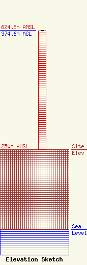
| Elevation Info |
Site Elevation: 250 meters (820 ft) |
| Height of Structure: 374 meters (1227 feet) |
| Overall Height Above Ground: 374.6 meters (1229 feet) |
| Overall Height Above Mean Sea Level: 624.6 meters (2049 feet) |
| Owner Info | VERTICAL BRIDGE S3 ASSETS, LLC
750 Park of Commerce
boca Raton, FL 33487
(561) 406-4015
fcc-faa@verticalbridge.com |
| Contact Info | VERTICAL BRIDGE S3 ASSETS, LLC
750 Park of Commerce
boca Raton, FL 33487
(561) 406-4015
fcc-faa@verticalbridge.com |
