|
|
Antenna Structure Registration 1045309 |
 |
Registration Info | Registration Number: 1045309 |
| File Number: A0725496 |
| FAA Study: 2011-AEA-1252-OE |
| FAA Issue Date: 04/07/2011 |
| Status: Constructed |
| Date Constructed: 04/15/2011 |
| FAA EMI: N |
| NEPA: N |
Structure Info
| Structure Type: TOWER |
| Structure Coordinates: 38-56-10.6 N 77-5-31.5 W (NAD 83) |
| Structure Coordinates: 38-56-10.2 N 77-05-32.6 W (Converted to NAD 27) |
| Structure Address: 4400 Mass. Avenue, Nw |
| Structure City: Washington, DC |
| Structure County: District of Columbia |
| Painting & Lighting Info |
FAA Circular #: 70/7460-1K |
FAA Chapters: 4, 8, 12 |
Remarks: PRIOR STUDY 1997-AEA-4258-OE |
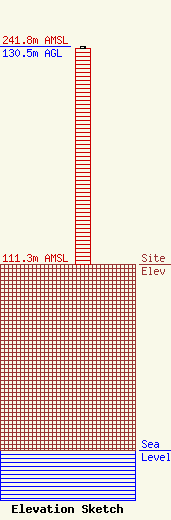
| Elevation Info |
Site Elevation: 111.3 meters (365 ft) |
| Height of Structure: 129.4 meters (425 feet) |
| Overall Height Above Ground: 130.5 meters (428 feet) |
| Overall Height Above Mean Sea Level: 241.8 meters (793 feet) |
| Owner Info | THE AMERICAN UNIVERSITY
4400 MASS AVE NW - BRANDYWINE BLDG
WASHINGTON, DC 20016
(202) 885-1264
AHEALY@WAMU.ORG |
| Contact Info | RADIO STATION WAMU
4400 MASS AVE NW - BRANDYWINE BLDG
WASHINGTON, DC 20016-8082
JOHN HOLT
(202) 885-1242
JHOLT@WAMU.ORG |
