|
|
Antenna Structure Registration 1064720 |
 |
Registration Info | Registration Number: 1064720 |
| File Number: A0739662 |
| FAA Study: 99-ASO-1709-OE |
| FAA Issue Date: 05/07/1999 |
| Status: Dismantled |
| Date Constructed: 01/01/1977 |
| FAA EMI: N |
| NEPA: N |
Structure Info
| Structure Type: BANT |
| Structure Coordinates: 30-41-34.0 N 88-2-30.0 W (NAD 83) |
| Structure Coordinates: 30-41-33.3 N 88-02-30.0 W (Converted to NAD 27) |
| Structure Address: 107 St. Francis Street |
| Structure City: Mobile, AL |
| Structure County: Mobile County |
| Painting & Lighting Info |
FCC Paragraph(s): 1, 3, 21 |
Remarks: OM&L TO REMAIN PAINT/RED LIGHTS AS PER PRIOR STUDY 77-SO-1203-OE. |
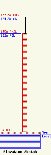
| Elevation Info |
Site Elevation: 3 meters (10 ft) |
| Height of Structure: 132 meters (433 feet) |
| Overall Height Above Ground: 154.5 meters (507 feet) |
| Overall Height Above Mean Sea Level: 157.5 meters (517 feet) |
| Owner Info | MOBILE TOWER PARTNERSHIP
107 ST. FRANCIS STREET, SUITE 1712
MOBILE, AL 36602
(334) 434-8120
|
