|
|
Antenna Structure Registration 1236511 |
 |
Registration Info | Registration Number: 1236511 |
| File Number: A0478042 |
| FAA Study: 2002-ANM-1933-OE |
| FAA Issue Date: 10/18/2002 |
| Status: Constructed |
| Date Constructed: 11/01/2002 |
| FAA EMI: N |
| NEPA: N |
Structure Info
| Structure Type: TOWER |
| Structure Coordinates: 38-29-12.9 N 107-51-32.2 W (NAD 83) |
| Structure Coordinates: 38-29-12.9 N 107-51-30.0 W (Converted to NAD 27) |
| Structure Address: 106 Rose Lane |
| Structure City: Montrose, CO |
| Structure County: Montrose County |
| Painting & Lighting Info |
FAA Chapters: NONE |
Remarks: Removed expiration date from determination. Scenario 1./jjs/case#635066 |
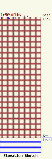
| Elevation Info |
Site Elevation: 1734.3 meters (5690 ft) |
| Height of Structure: 13.1 meters (43 feet) |
| Overall Height Above Ground: 13.7 meters (45 feet) |
| Overall Height Above Mean Sea Level: 1748 meters (5735 feet) |
| Owner Info | CCR-Montrose III, LLC
501 South Cherry Street, Ste 480
Denver, CO 80246
(303) 468-6500
|
| Contact Info | Drinker Biddle & Reath LLP
1500 K Street, NW, Suite 1100
Washington, DC 20005
Elizabeth Hammond
(202) 842-8843
elizabeth.hammond@dbr.com |
