|
|
Antenna Structure Registration 1295132 |
 |
Registration Info | Registration Number: 1295132 |
| File Number: A0973291 |
| FAA Study: 2014-AGL-12818-OE |
| FAA Issue Date: 01/08/2015 |
| Status: Constructed |
| Date Constructed: 04/01/1998 |
Structure Info
| Structure Type: LTOWER |
| Structure Coordinates: 37-44-46.0 N 89-3-15.6 W (NAD 83) |
| Structure Coordinates: 37-44-45.8 N 89-03-15.3 W (Converted to NAD 27) |
| Structure Address: 1431 Country Aire Drive |
| Structure City: Carterville, IL |
| Structure County: Williamson County |
| Painting & Lighting Info |
FAA Chapters: NONE |
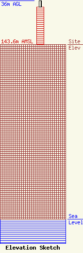
| Elevation Info |
Site Elevation: 143.6 meters (471 ft) |
| Height of Structure: 30.5 meters (100 feet) |
| Overall Height Above Ground: 36 meters (118 feet) |
| Overall Height Above Mean Sea Level: 179.6 meters (589 feet) |
| Owner Info | MRR License LLC
900 Laskin Road
Virginia Beach, VA 23451
(757) 437-9800
DWilhelm@MaxMediaLLC.com |
| Contact Info | MRR License LLC
900 Laskin Road
Virginia Beach, VA 23451
(757) 437-9800
DWilhelm@MaxMediaLLC.com |
