|
|
Antenna Structure Registration 1039521 |
 |
Registration Info | Registration Number: 1039521 |
| File Number: A1104590 |
| FAA Study: NOS 24-0254-4 |
| FAA Issue Date: 06/22/1973 |
| Status: Constructed |
| Date Constructed: 01/30/2002 |
| FAA EMI: N |
| NEPA: N |
Structure Info
| Structure Type: 4TA4 |
| Structure Coordinates: 44-47-22.0 N 93-12-53.0 W (NAD 83) |
| Structure Coordinates: 44-47-22.1 N 93-12-52.2 W (Converted to NAD 27) |
| Structure Address: 2110 Cliff Rd (twr 4) |
| Structure City: Eagan, MN |
| Structure County: Dakota County |
| Painting & Lighting Info |
FCC Paragraph(s): 1, 3, 11, 21 |
Remarks: RED LIGHTS/PAINT. |
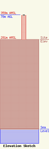
| Elevation Info |
Site Elevation: 281 meters (922 ft) |
| Height of Structure: 76.1 meters (250 feet) |
| Overall Height Above Ground: 78 meters (256 feet) |
| Overall Height Above Mean Sea Level: 359 meters (1178 feet) |
| Owner Info | Salem Communications Holding Corporation, Inc
4880 Santa Rosa Road
Camarillo, CA 93012
(805) 987-0400
scott.foster@salemmedia.com |
| Contact Info | Salem Media Group, Inc
4880 Santa Rosa Road
Camarillo, CA 93012
Scott Foster
(805) 384-4502
scott.foster@salemmedia.com |
