Accept
By using FCCInfo you agree to the terms & conditions. Read disclaimer Read privacy statement
FCCInfo.com

A Service of Cavell, Mertz & Associates, Inc.
(855) FCC-INFO

WNFT-LD
Call Sign History
WNFT-LD from 02/05/2007
WNFT-LP from 01/12/2007
Channel 15DT

Gainesville, FL
License
CP
Application
Allocation
STA


WNFT-LD Service: LD - Digital TV Translator or LPTV Station
Channel: 15 Zone:
Gainesville, Florida
Facility ID: 168484
FRN: 0005846795

Status: LIC
Application Accepted: 07/14/2011
License Expires: 02/01/2029
File Number: BLDTL-20110714ACG
Prefix Type: This is BLDTL

FCC Website Links:
  LMS Facility Details
  This Application
  Other WNFT-LD Applications
  Including Superseded Applications
  Service Contour - Open Street Map or USGS Map (51 dBu)
  Service Contour - KML / Google Earth (51 dBu)
  Rabbit Ears Info Search for WNFT-LD

Site Location: 29-37-47.3 N 82-34-24.5 W (NAD 83)
Site Location: 29-37-46.4 N 82-34-25.1 W (Converted to NAD 27)

ERP: 15 kW
Electrical Beam Tilt: 0.75 degrees
R/C AGL: 289.8 m (951 ft.)
R/C AMSL: 316 m (1037 ft.)
Emission Mask: Stringent

Site Elevation: 26.2 m. (86 ft.)
Height Overall*: 293.5 m (963 ft.)
(* As Filed In This Application, may differ from ASR Data, Below.)
Directional Antenna - Antenna Make/Model: Systems With Reliability Inc. SWLP16MC/CP MODIFIED (FCC PAT # 18054)
Antenna ID: 90209

Antenna Data for Antenna Id: 90209
WNFT-LD LD File: BLDTL-20110714ACG
Systems With Reliability Inc. - SWLP16MC/CP MODIFIED (FCC PAT # 18054)
Service: LD
Standard Pattern: Y
Pattern and Field Values Include a 120° Clockwise Rotation
AzimuthRatioAzimuthRatioAzimuthRatioAzimuthRatio
00.225100.240200.240300.330
400.520500.725600.880700.970
751.000800.980900.9601000.950
1100.9751201.0001300.9751400.950
1500.9601600.9801651.0001700.970
1800.8801900.7252000.5202100.330
2200.2402300.2402400.2252500.215
2600.2002700.2152800.2302900.245
3000.2503100.2453200.2303300.215
3400.2003500.215
Structure Information

Structure Registration Number 1029138

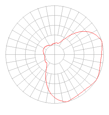
[ASR Heights Differ from WNFT-LD Application]
Structure Type: GTOWER
Registered To:
NexTower Development Group, LLC
Structure Address:
280 Ft West Of 21726 Sw 30th Ave
Newberry, FL
County Name: Alachua County
ASR Issued: 02/14/2019
Date Built: 03/14/2014
Site Elevation: 26.5 m (87 ft.)
Structure Height: 147.5 m (484 ft.)
Height Overall: 147.5 m (484 ft.)
Overall Height AMSL: 174 m (571 ft.)
FAA Determination: 08/01/2012
FAA Study #: 2012-ASO-4344-OE
Paint & Light FAA Chapters: NONE
PRIOR STUDY 1994-ASO-492-OE
29-37-47.3 N 82-34-24.5 W (NAD 83)
29-37-46.4 N 82-34-25.1 W
(Converted to NAD 27)
WNFT-LD Licensee Information

Budd Broadcasting Co., Inc.
4150 N. W. 93rd Ave
Gainesville, FL 32653
Phone: 352-371-7772
Corporation
20110714ACG Applicant Information

Harvey Budd
Date: 07/14/2011
Application Certifier
Budd Broadcasting Co., Inc.
4150 NW 93rd Avenue
Gainsville, FL 32653
Applicant
Robert Carr
4818 NW 17th Pl
Gainesville, FL 32605
Consulting Engineer
Aaron P. Shainis
Shainis & Peltzman, Chartered

Associated Land Mobile Licenses


(No Records Found)
Associated Microwave Licenses


(No Records Found)

Study Date: 4/01/2025; Study Duration: 0.0678 Seconds.
Database Sources:
04/01/2025 FCC LMS,
4/1/2025 FCC ASR,
4/1/2025 FCC ULS Microwave, and
4/1/2025 FCC ULS Broadcast Land Mobile.


© 2025 Capitol Airspace Group, LLC.
Alexandria, Virginia


If you have questions or concerns about the station above please contact the station Licensee.
Comments and questions about FCCInfo can be emailed to: webmaster@fccinfo.com