Accept
By using FCCInfo you agree to the terms & conditions. Read disclaimer Read privacy statement
FCCInfo.com

A Service of Cavell, Mertz & Associates, Inc.
(855) FCC-INFO

WFCM-FM
Call Sign History
WFCM-FM from 09/08/1997
WFCM from 06/26/1995
91.7 MHz

Murfreesboro, TN
License
CP
Application
Allocation
STA


WFCM-FM Channel: 219C3 91.7 MHz
Murfreesboro, Tennessee
Service: FM - A full-service FM station or application.
Facility ID: 66111
FRN: 0006791354
Fac. Service: FM

Status: LIC
Application Accepted: 04/11/2005
Application Granted: 03/06/2007
File Number: BLED-20050411AAI
License Expires: 08/01/2028
Prefix Type: This is a license for a noncommercial educational FM station
Application Type: Amendment

FCC Website Links:
  LMS Facility Details
  This Application
  Other WFCM-FM Applications
  Including Superseded Applications
  Service Contour - Open Street Map or USGS Map (60 dBu)
  Service Contour - KML / Google Earth (60 dBu)
  Public Inspection Files

Facility Type: NON-COMMERCIAL EDUC. FM
Class: C3, A Zone II station; with 6kW-25kW ERP and a class contour distance 28km-39km

Site Location: 35-48-01.2 N 86-37-17.0 W (NAD 83)
Site Location: 35-48-01.0 N 86-37-17.0 W (Converted to NAD 27)

Effective Radiated Power: 2.5 kW Horiz. ; 2.48 kW Vert.
Transmitter Output Power: 4.16 kW
Antenna Center HAAT: 231 m (758 ft.)
Antenna Center AMSL: 468 m (1535 ft.)
Antenna Center HAG: 152 m (499 ft.)

Site Elevation: 316 m. (1037 ft.)
Height Overall*: 229.3 m (752 ft.)
(* As Filed In This Application, may differ from ASR Data, Below.)
Directional Antenna
Antenna Make/Model: Electronics Research Inc. 1093-1CP-DA
Antenna ID: 60140
Polarization:

Antenna Data for Antenna Id: 60140
WFCM-FM FM File: BLED-20050411AAI
Electronics Research Inc. - 1093-1CP-DA
Service: FM
AzimuthRatioAzimuthRatioAzimuthRatioAzimuthRatio
00.818100.649200.516300.460
400.519500.582600.642700.733
800.822900.8911000.9441100.891
1200.7941300.7081400.6491500.615
1600.6491700.6681800.6881900.708
2000.7942101.0002201.0002301.000
2401.0002501.0002601.0002701.000
2801.0002901.0003001.0003101.000
3201.0003301.0003401.0003501.000
Structure Information

Structure Registration Number 1043245

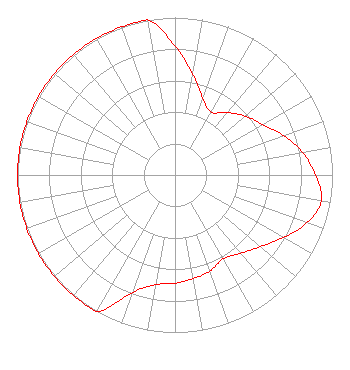
Structure Type: GTOWER
Registered To:
GREAT COUNTRY TOWERS, INC.
Structure Address:
Atop Mccord Knob
Kirkland, TN
County Name: Williamson County
ASR Issued: 08/11/2014
Date Built: 08/15/2014
Site Elevation: 316 m (1037 ft.)
Structure Height: 228.9 m (751 ft.)
Height Overall: 229.3 m (752 ft.)
Overall Height AMSL: 545.3 m (1789 ft.)
FAA Determination: 06/12/2014
FAA Study #: 2014-ASO-5039-OE
FAA Circular #: 70/7460-1K
Paint & Light FAA Chapters: 3, 4, 5, 12
PRIOR STUDY 1999-ASO-713-OE CHAPTERS 3,4,5,12 (1K) ADD SPECIAL CONDITION FOR LIGHTING DEVIATION.
35-48-01.0 N 86-37-17.0 W (NAD 83)
35-48-00.8 N 86-37-17.0 W
(Converted to NAD 27)
WFCM-FM Licensee Information

The Moody Bible Institute of Chicago
820 North Lasalle Boulevard
Chicago, IL 60610-3214
Phone: 312-329-4438
Private Not-for-Profit Educational Institution
20050411AAI Applicant Information

Robert Gunter
Date: 04/11/2005
Application Certifier
The Moody Bible Institute of Chicago
820 North Lasalle Boulevard
Chicago, IL 60610-3284
Applicant
John J. Mullaney
Mullaney Engineering, Inc.
9049 Shady Grove Court
Gaithersburg, MD 20877
Consulting Engineer
Jeffrey D. Southmayd
Southmayd & Miller

Associated Land Mobile Licenses


(No Records Found)
Associated Microwave Licenses


(No Records Found)

Study Date: 4/19/2025; Study Duration: 0.1796 Seconds.
Database Sources:
04/18/2025 FCC LMS,
4/15/2025 FCC ASR,
4/15/2025 FCC ULS Microwave, and
4/15/2025 FCC ULS Broadcast Land Mobile.


© 2025 Capitol Airspace Group, LLC.
Alexandria, Virginia


If you have questions or concerns about the station above please contact the station Licensee.
Comments and questions about FCCInfo can be emailed to: webmaster@fccinfo.com