|
WGER Channel: 292A 106.3 MHz
Saginaw, Michigan
Service: FM - A full-service FM station or application.
Facility ID: 20384
FRN: 0022491476
Fac. Service: FM
Status: LIC
73.215 Station
Application Accepted: 07/13/2004
Application Granted: 08/10/2005
File Number: BLH-20040713AAC
License Expires: 10/01/2028
Prefix Type: This is a license for a commercial FM station
Application Type: Amendment
FCC Website Links:
LMS Facility Details
This Application
Other WGER Applications
Including Superseded Applications
Service Contour - Open Street Map or USGS Map (60 dBu)
Service Contour - KML / Google Earth (60 dBu)
Public Inspection Files
Facility Type: FM STATION
Class: A, A Zone I; I-A; or II station; with 0.1kW-6kW ERP and a class contour distance <=28km
Site Location: 43-28-36.1 N 83-57-05.9 W (NAD 83)
Site Location: 43-28-36.0 N 83-57-06.0 W (Converted to NAD 27)
Effective Radiated Power: 4.4 kW
Transmitter Output Power: 1.925 kW
Antenna Center HAAT: 116 m (381 ft.)
Antenna Center AMSL: 299 m (981 ft.)
Antenna Center HAG: 119 m (390 ft.)
Calculated Site Elevation: 180 m. (591 ft.)
Height Overall*: 129 m (423 ft.)
(* As Filed In This Application, may differ from ASR Data, Below.)
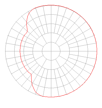
Directional Antenna
Antenna Make/Model: Electronics Research Inc. LP-6E-DA-HW, 6 section, 0.5 wavelength spaced
Antenna ID: 65626
Polarization:
|
Structure Information
Structure Registration Number 1005873
[ASR Heights Differ from WGER Application]
Structure Type: GTOWER
Registered To:
Vertical Bridge S3 Assets, LLC
Structure Address:
1795 Tittabawassee Rd
Saginaw, MI
County Name: Saginaw County
ASR Issued: 03/13/2026
Date Built: 01/01/1969
Site Elevation: 179.8 m (590 ft.)
Structure Height: 121.9 m (400 ft.)
Height Overall: 123.1 m (404 ft.)
Overall Height AMSL: 302.9 m (994 ft.)
FAA Determination: 01/07/2026
FAA Study #: 2025-AGL-15643-OE
Paint & Light FAA Chapters: 1, 3, 12, 21
PRIOR STUDY 2024-AGL-17258-OE
43-28-36.5 N 83-57-05.8 W (NAD 83)
43-28-36.4 N 83-57-05.9 W
(Converted to NAD 27)
|
WGER(FM) Licensee Information
Alpha Media Licensee LLC
180 Post Road East
Suite 201
Westport, CT 06880
Phone: 203-227-1978
Limited Liability Company | 20040713AAC Applicant Information
Matthew L. Leibowitz
Date: 07/13/2004
Application Certifier
NM Licensing LLC
6312 South Fiddlers Green Cir.
Suite 360-E
Englewood, CO 80111
Applicant
Mark Stennett
6312 South Fiddler's Green Circle
Suite 360 East
Englewood, CO 80111
VP, Engineering
Joseph A. Belisle
Leibowitz & Associates
|