Accept
By using FCCInfo you agree to the terms & conditions. Read disclaimer Read privacy statement
FCCInfo.com

A Service of Cavell, Mertz & Associates, Inc.
(855) FCC-INFO

WOOT-LD
Call Sign History
WOOT-LD from 08/25/2015
WOOT-LP from 01/02/2013
DWOOT-LP from 12/05/2012
WOOT-LP from 02/22/2000
W06BG from 04/29/1988
W67BD from 02/04/1985
810116X6 from ???
Channel 19DT

Chattanooga, TN
License
CP
Application
Allocation
STA


WOOT-LD Service: LD - Digital TV Translator or LPTV Station
Channel: 19 Zone:
Chattanooga, Tennessee
DTV TSID: 8119
Facility ID: 31862
FRN: 0021329800

Status: LIC
Application Accepted: 03/23/2020
License Expires: 08/01/2029
File Number: 0000108610

FCC Website Links:
  LMS Facility Details
  This Application
  Other WOOT-LD Applications
  Including Superseded Applications
  Service Contour - Open Street Map or USGS Map (51 dBu)
  Service Contour - KML / Google Earth (51 dBu)
  Rabbit Ears Info Search for WOOT-LD

Site Location: 35-12-26.0 N 85-16-52.0 W (NAD 83)
Site Location: 35-12-25.7 N 85-16-52.1 W (Converted to NAD 27)

ERP: 15 kW
Polarization: Horizontally polarized
Electrical Beam Tilt: 1.0 degree
R/C AGL: 71.7 m (235 ft.)
R/C AMSL: 685 m (2247 ft.)
Emission Mask: Full Service

Site Elevation: 613.3 m. (2012 ft.)
Height Overall*: 150.3 m (493 ft.)
(* As Filed In This Application, may differ from ASR Data, Below.)
Directional Antenna - Antenna Make/Model: PS PSILP12OI
Antenna ID: 1006580
Polarization: Horizontally polarized

Antenna Data for Antenna Id: 1006580
WOOT-LD LD File: -0000108610
PS - PSILP12OI
Service: LD
Standard Pattern: N
Pattern and Field Values Include a 175° Clockwise Rotation
AzimuthRatioAzimuthRatioAzimuthRatioAzimuthRatio
50.670150.660250.640350.620
450.600550.600650.610750.630
850.660950.7101050.7601150.820
1250.8701350.9101450.9501550.980
1651.0001751.0001851.0001950.980
2050.9502150.9102250.8702350.820
2450.7602550.7102650.6602750.630
2850.6102950.6003050.6003150.620
3250.6403350.6603450.6703550.670
Structure Information

Structure Registration Number 1042763

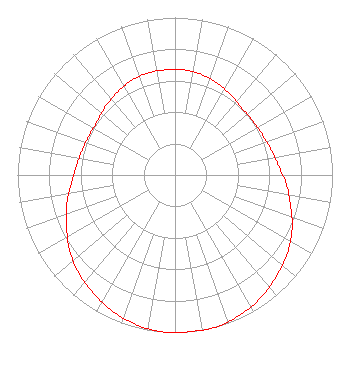
[ASR Heights Differ from WOOT-LD Application]
Structure Type: GTOWER
Registered To:
GREATER CHATTANOOGA PUBLIC TELEVISION CORPORATION
Structure Address:
Sawyer Cemetery Rd
Signal Mountain, TN
County Name: Hamilton County
ASR Issued: 06/09/2022
Date Built: 06/10/2022
Site Elevation: 613.3 m (2012 ft.)
Structure Height: 135.6 m (445 ft.)
Height Overall: 135.6 m (445 ft.)
Overall Height AMSL: 748.9 m (2457 ft.)
FAA Determination: 09/09/2014
FAA Study #: 2014-ASO-8387-OE
FAA Circular #: 70/7460-1K
Paint & Light FAA Chapters: 3, 4, 5, 12
PRIOR STUDY 1992-ASO-1871-OE
35-12-26.0 N 85-16-52.0 W (NAD 83)
35-12-25.7 N 85-16-52.1 W
(Converted to NAD 27)
WOOT-LD Licensee Information

Digital Networks-Southeast, LLC
Chattanooga, TN 37401
Phone: 202-293-0567
Limited Liability Company
0000108610 Applicant Information

Joel Wertman
Title: Coo
Date: 03/23/2020
Application Certifier
Digital Networks-Southeast, LLC
Chattanooga, TN 37401
Applicant
Jeremy D Ruck, PE
Jeremy Ruck & Associates, Inc.
Canton, IL 61520
Consulting Engineer
Aaron P Shainis, Esq
Shainis & Peltzman, Chartered
1850 M Street NW
Suite 240
Washington, DC 20036
Attorney
Associated Land Mobile Licenses


(No Records Found)
Associated Microwave Licenses


 WLI258 TV Studio Transmitter Link

Study Date: 4/01/2025; Study Duration: 0.0649 Seconds.
Database Sources:
04/01/2025 FCC LMS,
4/1/2025 FCC ASR,
4/1/2025 FCC ULS Microwave, and
4/1/2025 FCC ULS Broadcast Land Mobile.


© 2025 Capitol Airspace Group, LLC.
Alexandria, Virginia


If you have questions or concerns about the station above please contact the station Licensee.
Comments and questions about FCCInfo can be emailed to: webmaster@fccinfo.com