|
W254CR Channel: 254D 98.7 MHz
Latrobe, Pennsylvania
Service: FX - A translator or application for a translator.
Facility ID: 153162
FRN: 0029352077
Fac. Service: FX
Programming Delivery Method: Unspecified
Status: LIC
Application Accepted: 06/11/2021
Application Granted: 07/28/2021
File Number: 0000150039
License Expires: 08/01/2030
Application Type: License To Cover
FCC Website Links:
LMS Facility Details
This Application
Other W254CR Applications
Including Superseded Applications
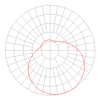
Service Contour - Open Street Map or USGS Map (60 dBu)
Service Contour - KML / Google Earth (60 dBu)
Facility Type: FM STATION
Class: D, A Noncommercial educational operating with no more than 10W
Site Location: 40-23-18.6 N 79-27-48.8 W (NAD 83)
Site Location: 40-23-18.4 N 79-27-49.7 W (Converted to NAD 27)
Effective Radiated Power: 0 kW Horiz. ; 0.18 kW Vert.
Transmitter Output Power: 0.13 kW
Antenna Center AMSL: 0 m Horiz.; 465.2 m Vert.
Antenna Center HAG: 0 m Horiz.; 90 m Vert.
Site Elevation: 375.2 m. (1231 ft.)
Height Overall*: 95.4 m (313 ft.)
(* As Filed In This Application, may differ from ASR Data, Below.)
Directional Antenna
Antenna Make/Model: BEXT BKY3
Antenna ID: 124750
Polarization: H
| Primary Station |
| WJFA(AM) |
Ch. 0 | Apollo, Pennsylvania |
|
Structure Information
Structure Registration Number 1051477
Structure Type: TOWER
Registered To:
Crown Communications LLC
Structure Address:
Rd. 2, Box 690/devinney Rd.
North Alexandria, PA
County Name: Westmoreland County
ASR Issued: 05/06/2016
Date Built: 05/27/1998
Site Elevation: 375.2 m (1231 ft.)
Structure Height: 91.4 m (300 ft.)
Height Overall: 95.4 m (313 ft.)
Overall Height AMSL: 470.6 m (1544 ft.)
FAA Determination: 05/16/2006
FAA Study #: 2006-AEA-1826-OE
FAA Circular #: 70/7460-1K
Paint & Light FAA Chapters: 4, 6, 12
PRIOR STUDY 2005-AEA-3274-OE
40-23-18.6 N 79-27-48.8 W (NAD 83)
40-23-18.4 N 79-27-49.7 W
(Converted to NAD 27)
|
W254CR(FX) Licensee Information
Disruptor Radio LLC
5302 Coleway Drive
Holly Springs, NC 27450
Phone: 757-692-1710
Limited Liability Company | 0000150039 Applicant Information
James J Kail
Title: President
Date: 06/11/2021
Application Certifier
LHTC Media, Inc
LHTC Media, Inc
4157 Main Street
Stahlstown, PA 15687
Applicant
Jim Turvaville
Turbo Tech Services
360 Patton Street - PO Box 144
Mobeetie, TX 79061
Consulting Engineer
|