Accept
By using FCCInfo you agree to the terms & conditions. Read disclaimer Read privacy statement
FCCInfo.com

A Service of Cavell, Mertz & Associates, Inc.
(855) FCC-INFO

KJDN-LD
Call Sign History
KJDN-LD from 06/28/2011
K39KU-D from 06/02/2010
Channel 6DT

Logan, UT
License
CP
Application
Allocation
STA


KJDN-LD Service: LD - Digital TV Translator or LPTV Station
Channel: 6 Zone:
Logan, Utah
Facility ID: 182236
FRN: 0011735222

Status: CP
Application Accepted: 01/11/2023
KJDN-LD CP Expires: 10/03/2022
File Number: 0000206706

FCC Website Links:
  LMS Facility Details
  This Application
  Other KJDN-LD Applications
  Including Superseded Applications
  Service Contour - Open Street Map or USGS Map (43 dBu)
  Service Contour - KML / Google Earth (43 dBu)
  Rabbit Ears Info Search for KJDN-LD

Site Location: 41-47-02.7 N 112-13-57.8 W (NAD 83)
Site Location: 41-47-03.0 N 112-13-55.0 W (Converted to NAD 27)

ERP: 2.39 kW
Polarization: Circularly polarized
R/C AGL: 15.2 m (50 ft.)
R/C AMSL: 2105.8 m (6909 ft.)
Emission Mask: Full Service

Site Elevation: 2090.6 m. (6859 ft.)
Height Overall*: 93 m (305 ft.)
(* As Filed In This Application, may differ from ASR Data, Below.)
Directional Antenna - Antenna Make/Model: American Amplifier Tech. IV-CP-BB-3
Antenna ID: 1010364
Polarization: Circularly polarized

Antenna Data for Antenna Id: 1010364
KJDN-LD LD File: -0000206706
American Amplifier Tech. - IV-CP-BB-3
Service: LD
Standard Pattern: N
Pattern and Field Values Include a 180° Clockwise Rotation
AzimuthRatioAzimuthRatioAzimuthRatioAzimuthRatio
00.290100.280200.270300.260
400.230500.210600.190700.180
800.180900.1901000.2201100.270
1200.3501300.5001400.6601500.820
1600.9201700.9601801.0001900.960
2000.9202100.8202200.6602300.500
2400.3502500.2702600.2202700.190
2800.1802900.1803000.1903100.210
3200.2303300.2603400.2703500.280
Structure Information

Structure Registration Number 1234946

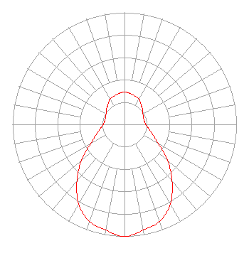
Structure Type: TOWER
Registered To:
Teton Communications Inc.
Structure Address:
Cal Mountain
Tremonton, UT
County Name: Box Elder County
ASR Issued: 03/26/2024
Date Built: 07/26/2002
Site Elevation: 2090.6 m (6859 ft.)
Structure Height: 93 m (305 ft.)
Height Overall: 93 m (305 ft.)
Overall Height AMSL: 2183.6 m (7164 ft.)
FAA Determination: 07/09/2002
FAA Study #: 2002-ANM-1213-OE
FAA Circular #: 70/7460-1K
Paint & Light FAA Chapters: 4, 8, 12
Removed expiration date from determination. Scenario 1./jjs/case#635066
41-47-02.7 N 112-13-57.8 W (NAD 83)
41-47-03.0 N 112-13-55.0 W
(Converted to NAD 27)
KJDN-LD Licensee Information

Soule Video Productions, Inc.
190 N 250 E #533
Millville, UT 84326
Phone: 435-757-2665
Corporation
0000206706 Applicant Information

Larry Soule
Title: President
Date: 01/11/2023
Application Certifier

Soule Video Productions, Inc.
190 N 250 E #533
Millville, UT 84326
Applicant
Aaron P Shainis
Shainis & Peltzman, Chartered
1850 M St NW
Suite 240
Washington, DC 20036
Legal Counsel
Scott Turpie
Lohnes & Culver, LLC
Alexandria, VA 22302
Sr. Technical Consultant
Associated Land Mobile Licenses


(No Records Found)
Associated Microwave Licenses


(No Records Found)

Study Date: 4/02/2025; Study Duration: 0.0642 Seconds.
Database Sources:
04/01/2025 FCC LMS,
4/1/2025 FCC ASR,
4/1/2025 FCC ULS Microwave, and
4/1/2025 FCC ULS Broadcast Land Mobile.


© 2025 Capitol Airspace Group, LLC.
Alexandria, Virginia


If you have questions or concerns about the station above please contact the station Licensee.
Comments and questions about FCCInfo can be emailed to: webmaster@fccinfo.com