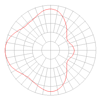
FCCInfo.com
A Service of Cavell, Mertz & Associates, Inc.
(855) FCC-INFO
|
WBXM-CA from 05/28/2001 W05BS from 06/03/1991 891208A3 from ??? |
|
|
||||||||||||||||
|
Status: STA – Special Temporary Authority Application Accepted: 05/20/2025 STA Expires: 04/02/2029 File Number: 0000271188 FCC Website Links: LMS Facility Details This Application Other WBXM-CD Applications Including Superseded Applications Service Contour - Open Street Map or USGS Map (51 dBu) Service Contour - KML / Google Earth (51 dBu) Public Inspection Files Rabbit Ears Info Search for WBXM-CD Site Location: 32-32-26.7 N 86-50-32.7 W (NAD 83) Site Location: 32-32-26.2 N 86-50-32.8 W (Converted to NAD 27) ERP: 15 kW Polarization: Elliptically polarized Electrical Beam Tilt: 1.0 degree R/C AGL: 304.8 m (1000 ft.) R/C AMSL: 447.4 m (1468 ft.) Emission Mask: Full Service Site Elevation: 142.6 m. (468 ft.) Height Overall*: 367.9 m (1207 ft.) (* As Filed In This Application, may differ from ASR Data, Below.) Directional Antenna - Antenna Make/Model: Dielectric TLP-12H/VP Antenna ID: 1008492 Polarization: Elliptically polarized | ||||||||||||||||||
Antenna Data for Antenna Id: 1008492 WBXM-CD DC File: -0000271188 Dielectric - TLP-12H/VP Service: DC Standard Pattern: Y Pattern and Field Values Include a 270° Clockwise Rotation | |||||||||||||||||||
Azimuth | Ratio | Azimuth | Ratio | Azimuth | Ratio | Azimuth | Ratio | ||||||||||||
0 | 0.911 | 10 | 0.880 | 20 | 0.788 | 30 | 0.673 | ||||||||||||
40 | 0.560 | 50 | 0.467 | 60 | 0.430 | 70 | 0.452 | ||||||||||||
80 | 0.495 | 90 | 0.521 | 100 | 0.511 | 110 | 0.477 | ||||||||||||
120 | 0.446 | 130 | 0.468 | 140 | 0.560 | 150 | 0.688 | ||||||||||||
160 | 0.810 | 170 | 0.891 | 180 | 0.918 | 190 | 0.885 | ||||||||||||
200 | 0.834 | 210 | 0.793 | 220 | 0.777 | 230 | 0.816 | ||||||||||||
240 | 0.885 | 250 | 0.949 | 260 | 0.984 | 270 | 1.000 | ||||||||||||
280 | 0.977 | 290 | 0.917 | 300 | 0.842 | 310 | 0.776 | ||||||||||||
320 | 0.768 | 330 | 0.779 | 340 | 0.828 | 350 | 0.885 | ||||||||||||
Structure Registration Number 1210735 Structure Type: Registered To: RADIANT LIFE MINISTRIES, INC. Structure Address: 1/4 Mile West Of Bonita Bonita, AL County Name: Autauga County ASR Issued: 09/10/2024 Date Built: 03/31/2020 Site Elevation: 142.6 m (468 ft.) Structure Height: 347.5 m (1140 ft.) Height Overall: 367.9 m (1207 ft.) Overall Height AMSL: 510.5 m (1675 ft.) FAA Determination: 10/26/2001 FAA Study #: 01-ASO-8117-OE Paint & Light FAA Chapters: A1, B, E, H, 3, 8, 17, 21, 23 PRIOR STUDY 99-ASO-3398-OE. OM&L TO REMAIN A HI-DUAL SYSTEM. 32-32-26.7 N 86-50-32.7 W (NAD 83) 32-32-26.2 N 86-50-32.8 W (Converted to NAD 27) |
4370 Peachtree Road, NE Atlanta, GA 30319 Phone: 404-504-9828 Limited Liability Company | Title: Assistant Secretary Date: 05/20/2025 Application Certifier WBXM-CD Gray Television Licensee, LLC 4370 Peachtree Road, NE Atlanta, GA 30319 Applicant David Burke Gray Television, Inc. 201 Monroe Street RSA Tower, 20th Floor Montgomery, AL 36104 Senior Vice President and Cto Joan Stewart Wiley Rein LLP 2050 M Street, NW Washington, DC 20036 | |||||||||||||||||