FCCInfo.com
A Service of Cavell, Mertz & Associates, Inc.
(855) FCC-INFO
|
WWLF-LP from ??? WOBX-LP from 04/24/1998 W35AQ from 10/15/1997 W49BF from 12/02/1991 W35AQ from 06/30/1988 870702YK from ??? |
|
|
||||||||||||||||
|
Status: LIC Application Accepted: 09/01/2020 License Expires: 06/01/2023 File Number: 0000120990 FCC Website Links: LMS Facility Details This Application Other WWLF-LD Applications Including Superseded Applications Service Contour - Open Street Map or USGS Map (51 dBu) Service Contour - KML / Google Earth (51 dBu) Rabbit Ears Info Search for WWLF-LD Site Location: 43-03-30.0 N 76-09-59.0 W (NAD 83) Site Location: 43-03-29.8 N 76-10-00.3 W (Converted to NAD 27) ERP: 5 kW Polarization: Horizontally polarized Electrical Beam Tilt: 1.0 degree R/C AGL: 89 m (292 ft.) R/C AMSL: 203.3 m (667 ft.) Emission Mask: Full Service Site Elevation: 114.3 m. (375 ft.) Height Overall*: 126.5 m (415 ft.) (* As Filed In This Application, may differ from ASR Data, Below.) Directional Antenna - Antenna Make/Model: Bogner B8UA Antenna ID: 18179 Polarization: Horizontally polarized | ||||||||||||||||||
Antenna Data for Antenna Id: 18179 WWLF-LD LD File: -0000120990 Bogner - B8UA Service: LD Standard Pattern: Y Pattern and Field Values Include a 220° Clockwise Rotation | |||||||||||||||||||
Azimuth | Ratio | Azimuth | Ratio | Azimuth | Ratio | Azimuth | Ratio | ||||||||||||
0 | 0.350 | 10 | 0.230 | 20 | 0.220 | 30 | 0.225 | ||||||||||||
40 | 0.230 | 50 | 0.225 | 60 | 0.220 | 70 | 0.230 | ||||||||||||
80 | 0.350 | 90 | 0.470 | 100 | 0.630 | 110 | 0.775 | ||||||||||||
120 | 0.875 | 130 | 0.950 | 140 | 0.980 | 150 | 1.000 | ||||||||||||
160 | 0.975 | 170 | 0.940 | 180 | 0.920 | 190 | 0.925 | ||||||||||||
200 | 0.950 | 210 | 0.970 | 220 | 1.000 | 230 | 0.970 | ||||||||||||
240 | 0.950 | 250 | 0.925 | 260 | 0.920 | 270 | 0.940 | ||||||||||||
280 | 0.975 | 290 | 1.000 | 300 | 0.980 | 310 | 0.950 | ||||||||||||
320 | 0.875 | 330 | 0.775 | 340 | 0.630 | 350 | 0.470 | ||||||||||||
Structure Registration Number 1007737 
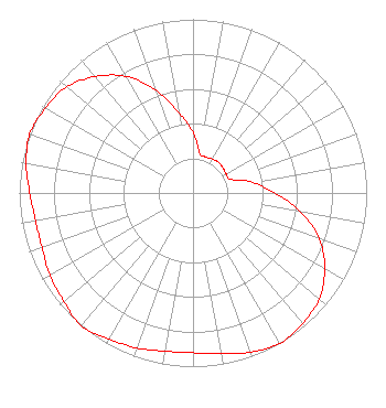
Structure Type: TOWER Registered To: WOLF RADIO INC Structure Address: 401 W Kirkpatrick St Syracuse, NY County Name: Onondaga County ASR Issued: 08/13/1997 Date Built: 07/23/1997 Site Elevation: 114.3 m (375 ft.) Structure Height: 125.6 m (412 ft.) Height Overall: 126.5 m (415 ft.) Overall Height AMSL: 240.8 m (790 ft.) FAA Determination: 10/22/1992 FAA Study #: 91-AEA-2250-OE FAA Circular #: 70/7460-1H Paint & Light FAA Chapters: 3, 4, 5, 13 43-03-30.0 N 76-09-59.0 W (NAD 83) 43-03-29.8 N 76-10-00.3 W (Converted to NAD 27) |
401 W. Kirkpatrick St. Syracuse, NY 13204 Phone: 315-468-0908 Corporation | Title: President Date: 09/01/2020 Application Certifier Metro TV, Inc. Metro TV, Inc. 401 W. Kirkpatrick St. Syracuse, NY 13204 Applicant Craig Fox Metro TV, Inc. 401 W. Kirkpatrick St. Syracuse, NY 13204 Technical Director James L. Oyster Law Offices of James L. Oyster 108 Oyster Lane Castleton, VA 22716 | |||||||||||||||||