|
| KFJX Service: DT - Digital TV | | Channel: 13 Zone: 2 |
| Pittsburg, Kansas |
| Nielsen DMA™: Joplin - Pittsburg |
| Network: FOX, CW, START TV, DABL |
| Virtual Channel: 14 |
| DTV TSID: 3905 |
| Facility ID: 83992 | | FRN: 0026541813 |
Status: LIC
Application Accepted: 07/11/2022
License Expires: 06/01/2030
File Number: 0000194731
FCC Website Links:
LMS Facility Details
This Application
Other KFJX Applications
Including Superseded Applications
Service Contour - Open Street Map or USGS Map (36 dBu)
Service Contour - KML / Google Earth (36 dBu)
Public Inspection Files
Rabbit Ears Info Search for KFJX
Site Location: 37-13-15.0 N 94-42-26.0 W (NAD 83)
Site Location: 37-13-14.8 N 94-42-25.2 W (Converted to NAD 27)
ERP: 45.1 kW
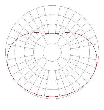
Polarization: Elliptically polarized
HAAT: 337 m (1106 ft.)
Electrical Beam Tilt: 0.5 degrees
R/C AGL: 336.5 m (1104 ft.)
R/C AMSL: 607.7 m (1994 ft.)
Site Elevation: 271.2 m. (890 ft.)
Height Overall*: 344.1 m (1129 ft.)
(* As Filed In This Application, may differ from ASR Data, Below.)
Directional Antenna - Antenna Make/Model: DIELECTRIC THV-8A13-R C145
Antenna ID: 1005210
Polarization: Elliptically polarized
|
Structure Information
Structure Registration Number 1032005
Structure Type: GTOWER
Registered To:
QueenB Television of Kansas/Missouri, LLC
Structure Address:
Int Hwy 69 & Lawton Rd 4 Mi W Of Lawton Ks
Pittsburg, KS
County Name: Cherokee County
ASR Issued: 06/22/2022
Date Built: 06/30/2022
Site Elevation: 271.2 m (890 ft.)
Structure Height: 310.3 m (1018 ft.)
Height Overall: 344.1 m (1129 ft.)
Overall Height AMSL: 615.3 m (2019 ft.)
FAA Determination: 06/17/2022
FAA Study #: 2022-ACE-2964-OE
FAA Circular #: 70/7460-1M
Paint & Light FAA Chapters: 4, 9, 15
PRIOR STUDY 2017-ACE-6793-OE
37-13-15.0 N 94-42-26.0 W (NAD 83)
37-13-14.8 N 94-42-25.2 W
(Converted to NAD 27)
|
KFJX(DT) Licensee Information
Sagamorehill of Missouri Licenses, LLC
525 Blackburn Drive
Augusta, GA 30907
Phone: 706-922-5644
Limited Liability Company | 0000194731 Applicant Information
Louis Wall
Title: President
Date: 07/11/2022
Application Certifier
Sagamorehill of Missouri Licenses, LLC
525 Blackburn Drive
Augusta, GA 30907
Applicant
Wayne D. Johnsen, Esq
Wiley Rein LLP
2050 M Street, N.W.
Washington, DC 20036
Erik C Swanson, PE
Hatfield & Dawson
9500 Greenwood Ave N
Seattle, WA 98103
Consulting Engineer
|