Accept
By using FCCInfo you agree to the terms & conditions. Read disclaimer Read privacy statement
FCCInfo.com

A Service of Cavell, Mertz & Associates, Inc.
(855) FCC-INFO

W231DB(FX)
Call Sign History
W231DB from 01/30/2017
W231DB from 03/16/2004
94.1 MHz

Lagrange, KY
License
CP
Application
Allocation
STA


W231DB Channel: 231D 94.1 MHz
Lagrange, Kentucky
Service: FX - A translator or application for a translator.
Facility ID: 156171
Fac. Service: FX
Programming Delivery Method: Unspecified

Status: LIC
Application Accepted: 12/13/2016
Application Granted: 01/30/2017
File Number: BLFT-20161213ABB
Prefix Type: This is a license for a translator
Application Type: Amendment

FCC Website Links:
  LMS Facility Details
  This Application
  CDBS Application
  Other W231DB Applications
  Other W231DB Applications in CDBS
  Including Superseded Applications
  Mailing Address
  Correspondence for W231DB
  Correspondence related to application BLFT-20161213ABB
  Service Contour - Open Street Map or USGS Map (60 dBu)
  Service Contour - KML / Google Earth (60 dBu)

Class: D, A Noncommercial educational operating with no more than 10W

Site Location: 38-21-09.2 N 85-11-08.8 W (NAD 83)
Site Location: 38-21-09.0 N 85-11-09.0 W (Converted to NAD 27)

Effective Radiated Power: 0.25 kW
Transmitter Output Power: 0.18 kW
Antenna Center HAAT: 0 m
Antenna Center AMSL: 345 m (1132 ft.)
Antenna Center HAG: 87 m (285 ft.)

Site Elevation: 258 m. (846 ft.)
Height Overall*: 99 m (325 ft.)
(* As Filed In This Application, may differ from ASR Data, Below.)
Directional Antenna
Antenna Make/Model: None
Antenna ID: 124402
Polarization:

Associated Facilities
WLUE (AM) Eminence, Kentucky
Antenna Data for Antenna Id: 124402
W231DB FX File: BLFT-20161213ABB
None -
Service: FX
AzimuthRatioAzimuthRatioAzimuthRatioAzimuthRatio
00.390100.330200.304300.291
400.287500.289600.294700.309
800.329900.3551000.4111100.490
1200.6101300.7501400.8701500.950
1601.0001701.0001801.0001901.000
2001.0002101.0002201.0002301.000
2401.0002501.0002601.0002701.000
2800.9802900.9403000.8803100.800
3200.7153300.6403400.5603500.470
Structure Information

Structure Registration Number 1205091

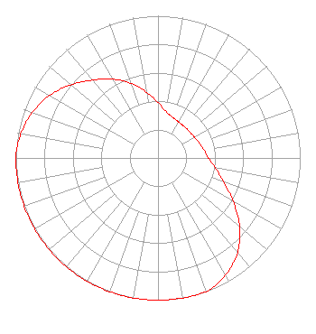
[ASR Heights Differ from W231DB Application]
Structure Type: Registered To:
UB LOUISVILLE, LLC
Structure Address:
State Rt. 55 South 2.3 Km From Eminence
Eminence, KY
County Name: Henry County
ASR Issued: 05/15/2014
Date Built: 01/01/2000
Site Elevation: 257.5 m (845 ft.)
Structure Height: 98.1 m (322 ft.)
Height Overall: 99.1 m (325 ft.)
Overall Height AMSL: 356.6 m (1170 ft.)
FAA Determination: 01/22/1988
FAA Study #: 87-ASO-2367-OE
Paint & Light FAA Chapters: 1, 3, 12, 21
RED LIGHTS/PAINT
38-21-09.2 N 85-11-08.8 W (NAD 83)
38-21-09.0 N 85-11-09.0 W
(Converted to NAD 27)
W231DB(FX) Licensee Information

NEW ALBANY BROADCASTING CO., INC.
220 Potters Lane
Clarksville, IN 47129
Phone: 502-584-2400
Corporation
20161213ABB Applicant Information

DAVID B. SMITH
Date: 12/13/2016
Application Certifier
NEW ALBANY BROADCASTING CO. INC.
P O Box 2623
Clarksville, IN 47131
Applicant
PETER C. BOYCE
Midamerica Electronics
410 Mt. Tabor Rd
New Albany, IN 47150
CONSULTANT
NEW ALBANY BROADCASTING CO., INC.
New Albany Broadcasting Co., Inc.
P O Box 2623
Clarksville, IN 47131

Associated Land Mobile Licenses


(No Records Found)
Associated Microwave Licenses


(No Records Found)

Study Date: 6/30/2024; Study Duration: 0.1566 Seconds.
Database Sources:
06/28/2024 FCC LMS,
6/25/2024 FCC ASR,
6/25/2024 FCC ULS Microwave, and
6/25/2024 FCC ULS Broadcast Land Mobile.


© 2024 Cavell Mertz & Associates, Inc.
Manassas, Virginia


If you have questions or concerns about the station above please contact the station Licensee.
Comments and questions about FCCInfo can be emailed to: webmaster@fccinfo.com