Accept
By using FCCInfo you agree to the terms & conditions. Read disclaimer Read privacy statement
FCCInfo.com

A Service of Cavell, Mertz & Associates, Inc.
(855) FCC-INFO

KJRE(DT)
Call Sign History
KJRE from 10/18/1991
891221KF from ???
Channel 20DT
Virtual Channel 19

Ellendale, ND
License
CP
Application
Allocation
STA


KJRE Service: DT - Digital TV
Channel: 20 Zone: 2
Ellendale, North Dakota
Nielsen DMA™:  Fargo - Valley City
Network: PBS
Virtual Channel: 19
DTV TSID: 1895
Facility ID: 53315
FRN: 0002476091

Status: LIC (Licensed And Reduced Power)
Application Accepted: 11/09/2004
License Expires: 04/01/2030
File Number: BLEDT-20041109AAB
Prefix Type: This is a license for a noncommercial educational digital TV station

FCC Website Links:
  LMS Facility Details
  This Application
  Other KJRE Applications
  Including Superseded Applications
  Service Contour - Open Street Map or USGS Map (41 dBu)
  Service Contour - KML / Google Earth (41 dBu)
  Public Inspection Files
  Rabbit Ears Info Search for KJRE

Site Location: 46-17-56.0 N 98-51-57.0 W (NAD 83)
Site Location: 46-17-56.1 N 98-51-55.6 W (Converted to NAD 27)

ERP: 72.3 kW
Polarization: Horizontally polarized
HAAT: 162.5 m (533 ft.)
Electrical Beam Tilt: 0.75 degrees
R/C AGL: 140 m (459 ft.)
R/C AMSL: 740.5 m (2429 ft.)

Site Elevation: 600.5 m. (1970 ft.)
Height Overall*: 152.4 m (500 ft.)
(* As Filed In This Application, may differ from ASR Data, Below.)
Directional Antenna - Antenna Make/Model: Andrew ALP32L3-HSW
Antenna ID: 64873
Polarization: Horizontally polarized

Antenna Data for Antenna Id: 64873
KJRE DT File: BLEDT-20041109AAB
Andrew - ALP32L3-HSW
Service: DT
Standard Pattern: Y
AzimuthRatioAzimuthRatioAzimuthRatioAzimuthRatio
00.241100.253200.302300.397
400.510500.605600.680700.758
800.845900.9221000.9751100.997
1200.9901300.9591400.9291500.925
1600.9511700.9851801.0001900.985
2000.9512100.9252200.9292300.959
2400.9902500.9972600.9752700.922
2800.8452900.7583000.6803100.605
3200.5103300.3973400.3023500.253
Structure Information

Structure Registration Number 1038022

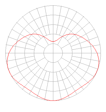
[ASR Heights Differ from KJRE Application]
Structure Type: GTOWER
Registered To:
Prairie Public Broadcasting, Inc.
Structure Address:
6.4km East Of Kulm
Kulm, ND
County Name: LaMoure County
ASR Issued: 08/22/2024
Date Built: 12/20/1991
Site Elevation: 602.6 m (1977 ft.)
Structure Height: 152.4 m (500 ft.)
Height Overall: 152.4 m (500 ft.)
Overall Height AMSL: 755 m (2477 ft.)
FAA Determination: 08/21/2024
FAA Study #: 2024-AGL-9744-OE
FAA Circular #: 70/7460-1M
Paint & Light FAA Chapters: 4, 8, 15
PRIOR STUDY 1997-AGL-4739-OE
46-17-55.4 N 98-51-57.7 W (NAD 83)
46-17-55.5 N 98-51-56.3 W
(Converted to NAD 27)
KJRE(DT) Licensee Information

Prairie Public Broadcasting, Inc.
Fargo, ND 58108
Phone: 701-241-6900
Not-for-Profit
20041109AAB Applicant Information

John E. Harris III
Date: 11/09/2004
Application Certifier
Prairie Public Broadcasting, Inc.
PO Box 3240
Fargo, ND 58108-3240
Applicant
Jim Solum
Prairie Public Broadcasting
P.O. Box 3240
Fargo, ND 58108-3240
Employee
Margaret L. Miller, Esquire
Dow, Lohnes & Albertson, PLLC

Associated Land Mobile Licenses


(No Records Found)
Associated Microwave Licenses


 WLI956 7 GHz TV Intercity Relay

Study Date: 4/01/2025; Study Duration: 0.039 Seconds.
Database Sources:
04/01/2025 FCC LMS,
4/1/2025 FCC ASR,
4/1/2025 FCC ULS Microwave, and
4/1/2025 FCC ULS Broadcast Land Mobile.


© 2025 Capitol Airspace Group, LLC.
Alexandria, Virginia


If you have questions or concerns about the station above please contact the station Licensee.
Comments and questions about FCCInfo can be emailed to: webmaster@fccinfo.com