|
| KUPX-TV Service: DT - Digital TV | | Channel: 29 Zone: 2 |
| Provo, Utah |
| Nielsen DMA™: Salt Lake City |
| Network: Utah 16 Grit Laff ION IONPlus Busted Game Show Central HSN HSN2 |
| Virtual Channel: 16 |
| DTV TSID: 2997 |
| Facility ID: 57884 | | FRN: 0001808468 |
Status: LIC
Application Accepted: 05/10/2002
License Expires: 10/01/2030
File Number: BLCDT-20020510AAP
Prefix Type: This is a License for a commercial digital TV station
FCC Website Links:
LMS Facility Details
This Application
Other KUPX-TV Applications
Including Superseded Applications
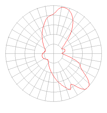
Service Contour - Open Street Map or USGS Map (41 dBu)
Service Contour - KML / Google Earth (41 dBu)
Public Inspection Files
Rabbit Ears Info Search for KUPX-TV
Site Location: 40-39-12.0 N 112-12-09.0 W (NAD 83)
Site Location: 40-39-12.2 N 112-12-06.2 W (Converted to NAD 27)
ERP: 530 kW
Polarization: Horizontally polarized
HAAT: 1171 m (3842 ft.)
Electrical Beam Tilt: 1 degree
R/C AGL: 59 m (194 ft.)
R/C AMSL: 2757 m (9045 ft.)
Site Elevation: 2698 m. (8852 ft.)
Height Overall*: 89 m (292 ft.)
(* As Filed In This Application, may differ from ASR Data, Below.)
Directional Antenna - Antenna Make/Model: DIELECTRIC DIELECTRIC TUP-SP2-12-1/TUP-SP1-4-1
Antenna ID: 18846
Polarization: Horizontally polarized
| Associated Translators |
| K25PH-D |
Ch. 25 | Roosevelt, Utah |
| K19LU-D |
Ch. 19 | Cedar City, Utah |
| K18GX-D |
Ch. 18 | Juab, Utah |
| K28PH-D |
Ch. 28 | Duchesne, Utah |
| K32ND-D |
Ch. 32 | Modena, Etc., Utah |
| K33QZ-D |
Ch. 33 | Fillmore, Etc., Utah |
| K21NN-D |
Ch. 21 | Scipio,holden, Utah |
| K18MQ-D |
Ch. 18 | Bluff & Area, Utah |
| K23OH-D |
Ch. 23 | Orangeville, Utah |
| K28PN-D |
Ch. 28 | Green River, Utah |
| K23JV-D |
Ch. 23 | Green River, Utah |
| K26PK-D |
Ch. 26 | Nephi, Utah |
| K26OI-D |
Ch. 26 | East Price, Utah |
| K33KI-D |
Ch. 33 | Spring Glen, Utah |
| K19MF-D |
Ch. 19 | East Carbon County, Utah |
| K25PM-D |
Ch. 25 | Helper, Utah |
| K28KQ-D |
Ch. 28 | Ferron, Utah |
| K29IW-D |
Ch. 29 | Clear Creek, Utah |
| K28KR-D |
Ch. 28 | Huntington, Utah |
| K21KL-D |
Ch. 21 | Rural Beaver County, Utah |
| K30KJ-D |
Ch. 30 | Manti & Ephrain, Utah |
| K02RI-D |
Ch. 2 | Cedar City Canyon, Utah |
| K34OO-D |
Ch. 34 | Blanding/monticello, Utah |
| K35NW-D |
Ch. 35 | Beaver Etc., Utah |
| K04RV-D |
Ch. 4 | Salina & Redmond, Utah |
| K18IV-D |
Ch. 18 | Mount Pleasant, Utah |
| K28PR-D |
Ch. 28 | Castle Dale, Utah |
| K23NT-D |
Ch. 23 | Mayfield, Utah |
| K10QR-D |
Ch. 10 | Leamington, Utah |
| K31LG-D |
Ch. 31 | Emery, Utah |
| K23NU-D |
Ch. 23 | Richfield, Etc., Utah |
| K28PE-D |
Ch. 28 | Kanarraville, Etc., Utah |
| K15LW-D |
Ch. 15 | Utahn, Utah |
|
Structure Information
Structure Registration Number 1040880
[ASR Heights Differ from KUPX-TV Application]
Structure Type: TOWER
Registered To:
Alpha Communications Sites, Inc
Structure Address:
Little Farnsworth Peak
Tooele, UT
County Name: Tooele County
ASR Issued: 05/06/2024
Date Built: 01/15/2010
Site Elevation: 2698.4 m (8853 ft.)
Structure Height: 68.8 m (226 ft.)
Height Overall: 68.8 m (226 ft.)
Overall Height AMSL: 2767.2 m (9079 ft.)
FAA Determination: 12/24/2009
FAA Study #: 2009-ANM-2322-OE
FAA Circular #: 70/7460-1K
Paint & Light FAA Chapters: 4, 6, 12
PRIOR STUDY 2009-ANM-2179-OE
40-39-12.0 N 112-12-09.0 W (NAD 83)
40-39-12.2 N 112-12-06.2 W
(Converted to NAD 27)
|
KUPX-TV Licensee Information
Ion Television License, LLC
312 Walnut Street
28th Floor
Cincinnati, OH 45202
Phone: 513-977-3000
Limited Liability Company | 20020510AAP Applicant Information
William L. Watson
Date: 05/10/2002
Application Certifier
Paxson Salt Lake City License, Inc.
601 Clearwater Park Road
West Palm Beach, FL 33401-6233
Applicant
Paul Titchenal
11300 4th St. N.
Suite 180
St. Petersburg, FL 33716
Director of Broadcast Development
Scott S. Patrick, Esq.
Dow, Lohnes & Albertson, PLLC
1200 New Hampshire Ave., NW
Suite 800
Washington, DC 20036-6802
|