|
KFXU Channel: 213C3 90.5 MHz
Chickasha, Oklahoma
Service: FM - A full-service FM station or application.
Facility ID: 87937
FRN: 0006238380
Fac. Service: FM
Status: LIC
Application Accepted: 01/25/2008
Application Granted: 03/11/2008
File Number: BLED-20080125ABE
License Expires: 06/01/2029
Prefix Type: This is a license for a noncommercial educational FM station
Application Type: Amendment
FCC Website Links:
LMS Facility Details
This Application
Other KFXU Applications
Including Superseded Applications
Service Contour - Open Street Map or USGS Map (60 dBu)
Service Contour - KML / Google Earth (60 dBu)
Public Inspection Files
Facility Type: NON-COMMERCIAL EDUC. FM
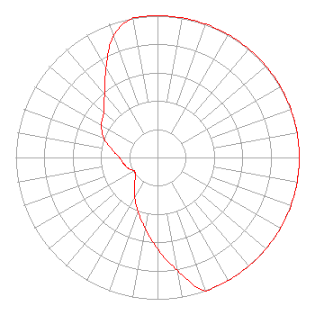
Class: C3, A Zone II station; with 6kW-25kW ERP and a class contour distance 28km-39km
Site Location: 34-54-33.2 N 97-57-30.2 W (NAD 83)
Site Location: 34-54-33.0 N 97-57-29.0 W (Converted to NAD 27)
Effective Radiated Power: 10 kW
Transmitter Output Power: 3.5 kW
Antenna Center HAAT: 98 m (322 ft.)
Antenna Center AMSL: 466 m (1529 ft.)
Antenna Center HAG: 85 m (279 ft.)
Calculated Site Elevation: 381 m. (1250 ft.)
Height Overall*: 92 m (302 ft.)
(* As Filed In This Application, may differ from ASR Data, Below.)
Directional Antenna
Antenna Make/Model: Shivley 6810-3R, THREE SECTIONS
Antenna ID: 83828
Polarization:
|
Structure Information
Structure Registration Number 1260615
Structure Type: TOWER
Registered To:
HOUSTON CHRISTIAN BROADCASTERS, INC.
Structure Address:
State Road
Ninekah, OK
County Name: Grady County
ASR Issued: 10/03/2017
Date Built: 11/01/2008
Site Elevation: 381 m (1250 ft.)
Structure Height: 92 m (302 ft.)
Height Overall: 92 m (302 ft.)
Overall Height AMSL: 473 m (1552 ft.)
FAA Determination: 08/14/2007
FAA Study #: 2007-ASW-4484-OE
FAA Circular #: 70/7460-1K
Paint & Light FAA Chapters: 3, 4, 5, 12
Removed expiration date from determination. Scenario 1./jjs/case#635066
34-54-33.0 N 97-57-30.0 W (NAD 83)
34-54-32.8 N 97-57-28.8 W
(Converted to NAD 27)
|
KFXU(FM) Licensee Information
Houston Christian Broadcasters, Inc.
2424 South Boulevard
Houston, TX 77098
Phone: 713-520-5200
Not-for-Profit | 20080125ABE Applicant Information
Sherry Austin
Date: 01/25/2008
Application Certifier
The Sister Sherry Lynn Foundation
1101 North 81 Highway
Marlow, OK 73055
Applicant
Jeffrey D Southmayd
Southmayd & Miller
1220 19th Street NW #400
Washington, DC 20036
Attorney
Jeffrey D. Southmayd
Southmayd & Miller
|