Accept
By using FCCInfo you agree to the terms & conditions. Read disclaimer Read privacy statement
FCCInfo.com

A Service of Cavell, Mertz & Associates, Inc.
(855) FCC-INFO

WYYW-CD
Call Sign History
WYYW-CD from 12/12/2012
WTSN-CD from 07/15/2009
WTSN-LD from 07/15/2009
WTSN-LP from 02/23/2009
WYYW-LP from 01/12/2009
W36DF from 03/16/2007
W56DN from 08/22/1995
940412DH from 08/22/1995
Channel 15DT

Evansville, IN
License
CP
Application
Allocation
STA


WYYW-CD Service: DC - Digital Class A Television Station
Channel: 15 Zone:
Evansville, Indiana
Nielsen DMA™:  Evansville
Network: Telemundo-Retro TV-Family
DTV TSID: 8865
Facility ID: 17742
FRN: 0003943834

Status: LIC
Application Accepted: 01/09/2013
License Expires: 08/01/2029
File Number: BLDTA-20130109AGB
Prefix Type: This is BLDTA

FCC Website Links:
  LMS Facility Details
  This Application
  Other WYYW-CD Applications
  Including Superseded Applications
  Service Contour - Open Street Map or USGS Map (51 dBu)
  Service Contour - KML / Google Earth (51 dBu)
  Public Inspection Files
  Rabbit Ears Info Search for WYYW-CD

Site Location: 37-59-13.0 N 87-16-11.0 W (NAD 83)
Site Location: 37-59-12.8 N 87-16-11.0 W (Converted to NAD 27)

ERP: 15 kW
Electrical Beam Tilt: 0.5 degrees
R/C AGL: 137 m (449 ft.)
R/C AMSL: 287.6 m (944 ft.)
Emission Mask: Stringent

Site Elevation: 150.6 m. (494 ft.)
Height Overall*: 182.9 m (600 ft.)
(* As Filed In This Application, may differ from ASR Data, Below.)
Directional Antenna - Antenna Make/Model: Andrew ALP16L2-HSOC
Antenna ID: 16531

Antenna Data for Antenna Id: 16531
WYYW-CD DC File: BLDTA-20130109AGB
Andrew - ALP16L2-HSOC
Service: DC
Standard Pattern: Y
Pattern and Field Values Include a 270° Clockwise Rotation
AzimuthRatioAzimuthRatioAzimuthRatioAzimuthRatio
00.668100.631200.609300.602
400.608500.623600.642700.659
800.672900.6761000.6721100.659
1200.6421300.6231400.6081500.602
1600.6091700.6311800.6681900.715
2000.7672100.8202200.8712300.915
2400.9512500.9782600.9942701.000
2800.9942900.9783000.9513100.915
3200.8713300.8203400.7673500.715
Structure Information

Structure Registration Number 1028661

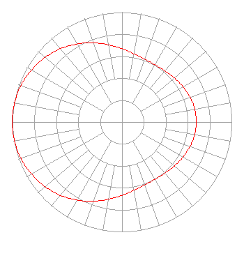
[ASR Heights Differ from WYYW-CD Application]
Structure Type: GTOWER
Registered To:
American Towers LLC
Structure Address:
1177 West New Hope Road (204169)
Evansville, IN
County Name: Warrick County
ASR Issued: 04/20/2018
Date Built: 02/02/1996
Site Elevation: 150.6 m (494 ft.)
Structure Height: 182.9 m (600 ft.)
Height Overall: 184.4 m (605 ft.)
Overall Height AMSL: 335 m (1099 ft.)
FAA Determination: 04/17/2018
FAA Study #: 2018-AGL-5840-OE
FAA Circular #: 70/7460-1L
Paint & Light FAA Chapters: 4, 8, 12
PRIOR STUDY 1992-AGL-319-OE
37-59-11.3 N 87-16-12.3 W (NAD 83)
37-59-11.1 N 87-16-12.3 W
(Converted to NAD 27)
WYYW-CD Licensee Information

Three Sisters Broadcasting, LLC
300 S.E. Riverside Drive
Suite 100
Evansville, IN 47713
Phone: 812-471-9300
Limited Liability Company
20130109AGB Applicant Information

John M. Dunn
Date: 01/09/2013
Application Certifier
Evansville Low Power Partnership
300 S.E. Riverside Drive
Suite 100
Evansville, IN 47713-1036
Applicant
David Hertel
4410 Aj Drive
Wadesville, IN 47638-8600
Consultant
Peter Tannenwald
Fletcher, Heald & Hildreth, P.L.C.

Associated Land Mobile Licenses


(No Records Found)
Associated Microwave Licenses


(No Records Found)

Study Date: 4/01/2025; Study Duration: 0.0729 Seconds.
Database Sources:
04/01/2025 FCC LMS,
4/1/2025 FCC ASR,
4/1/2025 FCC ULS Microwave, and
4/1/2025 FCC ULS Broadcast Land Mobile.


© 2025 Capitol Airspace Group, LLC.
Alexandria, Virginia


If you have questions or concerns about the station above please contact the station Licensee.
Comments and questions about FCCInfo can be emailed to: webmaster@fccinfo.com