|
K243CJ Channel: 243D 96.5 MHz
Pocatello, Idaho
Service: FX - A translator or application for a translator.
Facility ID: 153928
FRN: 0005017785
Fac. Service: FX
Programming Delivery Method: Unspecified
Status: LIC
Application Accepted: 11/15/2016
Application Granted: 12/08/2016
File Number: BLFT-20161115ACU
License Expires: 10/01/2029
Prefix Type: This is a license for a translator
Application Type: License To Cover
FCC Website Links:
LMS Facility Details
This Application
Other K243CJ Applications
Including Superseded Applications
Service Contour - Open Street Map or USGS Map (60 dBu)
Service Contour - KML / Google Earth (60 dBu)
Class: D, A Noncommercial educational operating with no more than 10W
Site Location: 42-51-45.7 N 112-31-05.9 W (NAD 83)
Site Location: 42-51-46.0 N 112-31-03.0 W (Converted to NAD 27)
Effective Radiated Power: 0.099 kW
Transmitter Output Power: 0.249 kW
Antenna Center AMSL: 1841 m (6040 ft.)
Antenna Center HAG: 61 m (200 ft.)
Site Elevation: 1780 m. (5840 ft.)
Height Overall*: 106 m (348 ft.)
(* As Filed In This Application, may differ from ASR Data, Below.)
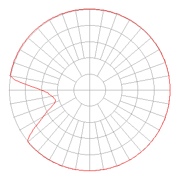
Directional Antenna
Antenna Make/Model: Propagation System Inc FML-1-DA
Antenna ID: 124537
Polarization:
| Primary Station |
| KOUU(AM) |
Ch. 0 | Pocatello, Idaho |
|
Structure Information
Structure Registration Number 1213130
Structure Type: TOWER
Registered To:
Idaho Wireless Inc
Structure Address:
On Howard Mountain West Of Pocatello 1/2 Mile
Pocatello, ID
County Name: Power County
ASR Issued: 08/03/2005
Date Built: 11/26/1994
Site Elevation: 1780 m (5840 ft.)
Structure Height: 105 m (344 ft.)
Height Overall: 106 m (348 ft.)
Overall Height AMSL: 1886 m (6188 ft.)
FAA Determination: 06/24/2004
FAA Study #: 2004-ANM-352-OE
FAA Circular #: 70/7460-1K
Paint & Light FAA Chapters: 3, 4, 5, 12
PRIOR STUDY 2000-ANM-50-OE
42-51-45.6 N 112-31-05.9 W (NAD 83)
42-51-45.9 N 112-31-03.0 W
(Converted to NAD 27)
|
K243CJ(FX) Licensee Information
Idaho Wireless Corporation
P.O. Box 97
Pocatello, ID 83204-0097
Phone: 208-234-1290
| 20161115ACU Applicant Information
Paul Anderson
Date: 11/15/2016
Application Certifier
Idaho Wireless Corporation
P.O. Box 97
Pocatello, ID 83204-0097
Applicant
Gene Wisniewski
160 Gooding Street West
Suite A
Twin Falls, ID 83301
Consulting Engineer
Idaho Wireless Corporation
Idaho Wireless Corporation
P.O. Box 97
Pocatello, ID 83204-0097
|