Accept
By using FCCInfo you agree to the terms & conditions. Read disclaimer Read privacy statement
FCCInfo.com

A Service of Cavell, Mertz & Associates, Inc.
(855) FCC-INFO

WDSV(FM)
Call Sign History
WDSV from 12/22/2008
91.9 MHz

Greenville, MS
License
CP
Application
Allocation
STA


WDSV Channel: 220A 91.9 MHz
Greenville, Mississippi
Service: FM - A full-service FM station or application.
Facility ID: 175995
FRN: 0016904666
Fac. Service: FM

Status: LIC
73.215 Station
Application Accepted: 03/11/2011
Application Granted: 03/18/2011
File Number: BLED-20110311ACF
License Expires: 06/01/2028
Prefix Type: This is a license for a noncommercial educational FM station
Application Type: License To Cover

FCC Website Links:
  LMS Facility Details
  This Application
  Other WDSV Applications
  Including Superseded Applications
  Service Contour - Open Street Map or USGS Map (60 dBu)
  Service Contour - KML / Google Earth (60 dBu)
  Public Inspection Files

Facility Type: NON-COMMERCIAL EDUC. FM
Class: A, A Zone I; I-A; or II station; with 0.1kW-6kW ERP and a class contour distance <=28km

Site Location: 33-24-21.4 N 90-59-30.4 W (NAD 83)
Site Location: 33-24-21.0 N 90-59-30.0 W (Converted to NAD 27)

Effective Radiated Power: 1.5 kW Horiz. ; 1.35 kW Vert.
Transmitter Output Power: 1.9 kW
Antenna Center HAAT: 105 m (344 ft.)
Antenna Center AMSL: 141 m (463 ft.)
Antenna Center HAG: 105 m (344 ft.)

Calculated Site Elevation: 36 m. (118 ft.)
Height Overall*: 115.8 m (380 ft.)
(* As Filed In This Application, may differ from ASR Data, Below.)
Directional Antenna
Antenna Make/Model: Shivley 6810-1-DA
Antenna ID: 103856
Polarization:

Antenna Data for Antenna Id: 103856
WDSV FM File: BLED-20110311ACF
Shivley - 6810-1-DA
Service: FM
AzimuthRatioAzimuthRatioAzimuthRatioAzimuthRatio
00.590100.575200.545300.550
400.585500.685600.860701.000
801.000901.0001001.0001101.000
1201.0001301.0001401.0001501.000
1601.0001701.0001801.0001901.000
2001.0002101.0002200.8652300.785
2400.7702500.7802600.8752700.890
2800.9202900.9003000.8203100.770
3200.7403300.7003400.6503500.610
Structure Information

Structure Registration Number 1039890

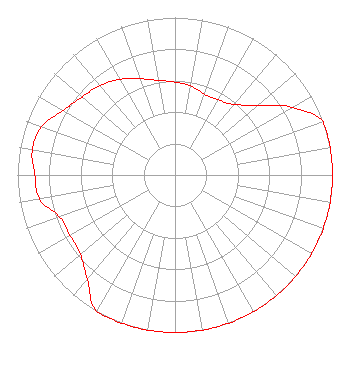
[ASR Heights Differ from WDSV Application]
Structure Type: TOWER
Registered To:
American Towers LLC
Structure Address:
2.4 Km East Of
Greenville, MS
County Name: Washington County
ASR Issued: 03/09/2022
Date Built: 03/25/1991
Site Elevation: 36.6 m (120 ft.)
Structure Height: 110.6 m (363 ft.)
Height Overall: 115.8 m (380 ft.)
Overall Height AMSL: 152.4 m (500 ft.)
FAA Determination: 11/19/1992
FAA Study #: 92-ASO-1649-OE
FAA Circular #: 70/7460-1H
Paint & Light FAA Chapters: 4, 5, 6, 8, 13
33-24-21.0 N 90-59-30.0 W (NAD 83)
33-24-20.6 N 90-59-29.6 W
(Converted to NAD 27)
WDSV(FM) Licensee Information

Delta Foundation, Inc.
819 Main Street
Greenville, MS 38701
Phone: 662-335-5291
Not-for-Profit
20110311ACF Applicant Information

Mashondia Redmond
Date: 03/11/2011
Application Certifier
Delta Foundation, Inc.
819 Main St.
Greenville, MS 38701
Applicant
Timothy L. Warner, P.E.
Timothy L. Warner, Inc.
Post Office Box 8045
Asheville, NC 28814-8045
Technical Consultant
Delta Foundation, Inc.

Associated Land Mobile Licenses


(No Records Found)
Associated Microwave Licenses


 WQNY720 950 MHz Aural Studio Transmitter Link

Study Date: 7/01/2025; Study Duration: 0.0907 Seconds.
Database Sources:
06/30/2025 FCC LMS,
6/24/2025 FCC ASR,
6/24/2025 FCC ULS Microwave, and
6/24/2025 FCC ULS Broadcast Land Mobile.


© 2025 Capitol Airspace Group, LLC.
Alexandria, Virginia


If you have questions or concerns about the station above please contact the station Licensee.
Comments and questions about FCCInfo can be emailed to: webmaster@fccinfo.com