FCCInfo.com
A Service of Cavell, Mertz & Associates, Inc.
(855) FCC-INFO
|
WLVO from 06/13/2017 WKHW from 08/07/2012 WRQQ from 07/16/2012 WLVU from 08/20/2007 WMBZ from 11/08/2006 WWWH from 09/06/2005 981023MB from 10/23/1998 |
|
|
||||||||||||||||
|
WKHW Channel: 203A 88.5 MHz Halifax, Pennsylvania Service: FM - A full-service FM station or application. Facility ID: 91925 FRN: 0004121000 Fac. Service: FM Status: LIC Application Accepted: 08/21/2008 Application Granted: 08/28/2008 File Number: BLED-20080821ADY License Expires: 08/01/2022 Prefix Type: This is a license for a noncommercial educational FM station Application Type: License To Cover FCC Website Links: LMS Facility Details This Application Other WKHW Applications Including Superseded Applications Service Contour - Open Street Map or USGS Map (60 dBu) Service Contour - KML / Google Earth (60 dBu) Public Inspection Files Facility Type: NON-COMMERCIAL EDUC. FM Class: A, A Zone I; I-A; or II station; with 0.1kW-6kW ERP and a class contour distance <=28km Site Location: 40-27-26.3 N 76-54-11.9 W (NAD 83) Site Location: 40-27-26.0 N 76-54-13.0 W (Converted to NAD 27) Effective Radiated Power: 1.4 kW Transmitter Output Power: 0.84 kW Antenna Center HAAT: 108 m (354 ft.) Antenna Center AMSL: 308 m (1010 ft.) Antenna Center HAG: 56 m (184 ft.) Calculated Site Elevation: 252 m. (827 ft.) Height Overall*: 82 m (269 ft.) (* As Filed In This Application, may differ from ASR Data, Below.) Directional Antenna Antenna Make/Model: Electronics Research Inc. LP-2E-DA Antenna ID: 83861 Polarization: | ||||||||||||||||||
Antenna Data for Antenna Id: 83861 WKHW FM File: BLED-20080821ADY Electronics Research Inc. - LP-2E-DA Service: FM | |||||||||||||||||||
Azimuth | Ratio | Azimuth | Ratio | Azimuth | Ratio | Azimuth | Ratio | ||||||||||||
0 | 1.000 | 10 | 1.000 | 20 | 1.000 | 30 | 1.000 | ||||||||||||
40 | 1.000 | 50 | 0.891 | 60 | 0.708 | 70 | 0.562 | ||||||||||||
80 | 0.447 | 90 | 0.355 | 100 | 0.282 | 110 | 0.224 | ||||||||||||
120 | 0.178 | 130 | 0.178 | 140 | 0.184 | 150 | 0.184 | ||||||||||||
160 | 0.211 | 170 | 0.257 | 180 | 0.292 | 190 | 0.367 | ||||||||||||
200 | 0.462 | 210 | 0.582 | 220 | 0.684 | 230 | 0.784 | ||||||||||||
240 | 0.891 | 250 | 1.000 | 260 | 1.000 | 270 | 1.000 | ||||||||||||
280 | 1.000 | 290 | 1.000 | 300 | 1.000 | 310 | 1.000 | ||||||||||||
320 | 1.000 | 330 | 1.000 | 340 | 1.000 | 350 | 1.000 | ||||||||||||
Structure Registration Number 1057211 
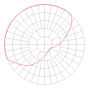
[ASR Heights Differ from WKHW Application] Structure Type: GTOWER Registered To: American Towers LLC Structure Address: 143 Hoover Dr. (010077 / Halifax Pa) Halifax, PA County Name: Dauphin County ASR Issued: 10/04/2016 Date Built: 10/19/1998 Site Elevation: 252 m (827 ft.) Structure Height: 82.3 m (270 ft.) Height Overall: 82.6 m (271 ft.) Overall Height AMSL: 334.6 m (1098 ft.) FAA Determination: 08/23/2016 FAA Study #: 2016-AEA-4598-OE FAA Circular #: 70/7460-1L Paint & Light FAA Chapters: 4, 8, 12 PRIOR STUDY 2008-AEA-2281-OE 40-27-26.5 N 76-54-12.4 W (NAD 83) 40-27-26.2 N 76-54-13.5 W (Converted to NAD 27) |
5700 West Oaks Blvd. Rocklin, CA 95765 Phone: 916-251-1600 Not-for-Profit | Date: 08/21/2008 Application Certifier Educational Media Foundation 5700 West Oaks Blvd Rocklin, CA 95765 Applicant Sam Wallington 5700 West Oaks Blvd Rocklin, CA 95765 VP of Engineering David D. Oxenford, Esq Davis Wright Tremaine LLP | |||||||||||||||||