Accept
By using FCCInfo you agree to the terms & conditions. Read disclaimer Read privacy statement
FCCInfo.com

A Service of Cavell, Mertz & Associates, Inc.
(855) FCC-INFO

W266BM(FX)
Call Sign History
W266BM from 12/04/2008
W266BM from 09/14/2000
101.1 MHz

Rural Retreat, VA
License
CP
Application
Allocation
STA


W266BM Channel: 266D 101.1 MHz
Rural Retreat, Virginia
Service: FX - A translator or application for a translator.
Facility ID: 84775
Fac. Service: FX
Programming Delivery Method: Unspecified

Status: License
Application Accepted: 11/04/2008
Application Granted: 12/04/2008
File Number: BLFT-20081104AFB
Prefix Type: This is a license for a translator
Application Type: License To Cover

FCC Website Links:
  LMS Facility Details
  This Application
  CDBS Application
  Other W266BM Applications
  Other W266BM Applications in CDBS
  Including Superseded Applications
  Mailing Address
  Correspondence for W266BM
  Correspondence related to application BLFT-20081104AFB
  Service Contour - Open Street Map or USGS Map (60 dBu)
  Service Contour - KML / Google Earth (60 dBu)

Class: D, A Noncommercial educational operating with no more than 10W

Site Location: 36-54-04.4 N 81-32-34.4 W (NAD 83)
Site Location: 36-54-04.0 N 81-32-35.0 W (Converted to NAD 27)

Effective Radiated Power: 0.25 kW
Transmitter Output Power: 0.165 kW
Antenna Center HAAT: 408.9 m Horiz.; 0 m Vert.
Antenna Center AMSL: 1163 m (3816 ft.)
Antenna Center HAG: 29 m (95 ft.)

Site Elevation: 1134 m. (3720 ft.)
Height Overall*: 66 m (217 ft.)
(* As Filed In This Application, may differ from ASR Data, Below.)
Directional Antenna
Antenna Make/Model: None
Antenna ID: 87854
Polarization:

Associated Facilities
WOLD-FM Marion, Virginia
Antenna Data for Antenna Id: 87854
W266BM FX File: BLFT-20081104AFB
None -
Service: FX
AzimuthRatioAzimuthRatioAzimuthRatioAzimuthRatio
00.249100.278200.285300.261
400.231500.204600.227700.325
800.473900.6011000.6841100.715
1200.7291300.6931400.6931500.732
1600.8001700.8551800.9061900.952
2001.0002100.9662200.9012300.769
2400.5862500.3852600.2482700.204
2800.2252900.2533000.2813100.280
3200.2523300.2093400.1873500.207
Structure Information

Structure Registration Number 1043028

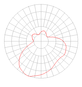
[ASR Heights Differ from W266BM Application]
Structure Type: TOWER
Registered To:
Bristol Broadcasting Company, Inc.
Structure Address:
Hwy 16 N Walker Mountain
Marion, VA
County Name: Smyth County
ASR Issued: 02/15/2017
Date Built: 05/12/2006
Site Elevation: 1133.8 m (3720 ft.)
Structure Height: 42.7 m (140 ft.)
Height Overall: 65.5 m (215 ft.)
Overall Height AMSL: 1199.3 m (3935 ft.)
FAA Determination: 03/24/2005
FAA Study #: 2005-AEA-709-OE
FAA Circular #: 70/7460-1J
Paint & Light FAA Chapters: 3, 4, 5, 13
OM&L to remain the same as prior study = PAINT/RED LIGHTS
36-54-04.8 N 81-32-34.5 W (NAD 83)
36-54-04.4 N 81-32-35.1 W
(Converted to NAD 27)
W266BM(FX) Licensee Information

BRISTOL BROADCASTING COMPANY, INC.
901 East Valley Drive
Bristol, VA 24201
Phone: 276-669-8112
20081104AFB Applicant Information

GEORGE E. DEVAULT, JR.
Date: 11/04/2008
Application Certifier
HOLSTON VALLEY BROADCASTING CORPORATION
222 Commerce Street
Kingsport, TN 37660
Applicant
DENNIS J. KELLY
Law Office Of Dennis J. Kelly
Post Office Box 41177
Washington, DC 20018-0577
ATTORNEY/CONSULTANT
DENNIS J. KELLY
Law Office Of Dennis J. Kelly
Post Office Box 41177
Washington, DC 20018-0577

Associated Land Mobile Licenses


(No Records Found)
Associated Microwave Licenses


(No Records Found)

Study Date: 6/16/2024; Study Duration: 0.1416 Seconds.
Database Sources:
06/14/2024 FCC LMS,
6/11/2024 FCC ASR,
6/11/2024 FCC ULS Microwave, and
6/11/2024 FCC ULS Broadcast Land Mobile.


© 2024 Cavell Mertz & Associates, Inc.
Manassas, Virginia


If you have questions or concerns about the station above please contact the station Licensee.
Comments and questions about FCCInfo can be emailed to: webmaster@fccinfo.com