Accept
By using FCCInfo you agree to the terms & conditions. Read disclaimer Read privacy statement
FCCInfo.com

A Service of Cavell, Mertz & Associates, Inc.
(855) FCC-INFO

KLWY(DT)
Call Sign History
KLWY from 10/31/1985
DKLWY from 03/28/1985
KLWY from 12/22/1981
Channel 27DT
Virtual Channel 27

Cheyenne, WY
License
CP
Application
Allocation
STA


KLWY Service: DT - Digital TV
Channel: 27 Zone: 2
Cheyenne, Wyoming
Nielsen DMA™:  Cheyenne - Scottsbluff
Network: FOX
Virtual Channel: 27
DTV TSID: 3297
Facility ID: 40250
FRN: 0029636065

Status: LIC
Application Accepted: 02/27/2009
License Expires: 10/01/2030
File Number: BLCDT-20090227AAD
Prefix Type: This is a License for a commercial digital TV station

FCC Website Links:
  LMS Facility Details
  This Application
  Other KLWY Applications
  Including Superseded Applications
  Service Contour - Open Street Map or USGS Map (41 dBu)
  Service Contour - KML / Google Earth (41 dBu)
  Public Inspection Files
  Rabbit Ears Info Search for KLWY

Site Location: 41-03-00.5 N 104-53-33.5 W (NAD 83)
Site Location: 41-03-00.6 N 104-53-31.6 W (Converted to NAD 27)

ERP: 169 kW
Polarization: Horizontally polarized
HAAT: 232 m (761 ft.)
Electrical Beam Tilt: 0.5 degrees
R/C AGL: 184.4 m (605 ft.)
R/C AMSL: 2135.4 m (7006 ft.)

Site Elevation: 1951 m. (6401 ft.)
Height Overall*: 193.5 m (635 ft.)
(* As Filed In This Application, may differ from ASR Data, Below.)
Directional Antenna - Antenna Make/Model: Bogner BUI28G
Antenna ID: 87213
Polarization: Horizontally polarized

Antenna Data for Antenna Id: 87213
KLWY DT File: BLCDT-20090227AAD
Bogner - BUI28G
Service: DT
Standard Pattern: Y
AzimuthRatioAzimuthRatioAzimuthRatioAzimuthRatio
00.520100.700200.880300.980
351.000400.990500.940600.820
700.550800.420900.4001000.390
1100.3601200.3801300.4001400.400
1500.5001600.7701700.9201800.990
1851.0001900.9902000.9202100.750
2200.5502300.4202400.3002500.240
2600.2002700.2002800.2202900.230
3000.2203100.2003200.2003300.220
3400.2803500.380
Structure Information

Structure Registration Number 1001101

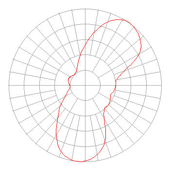
[ASR Heights Differ from KLWY Application]
Structure Type: TOWER
Registered To:
Wyomedia Corp.
Structure Address:
Off Us Rt 87 .6 Mi Se Of Speer Rd
Cheyenne, WY
County Name: Laramie County
ASR Issued: 10/20/2009
Date Built: 12/04/2009
Site Elevation: 1940.7 m (6367 ft.)
Structure Height: 177 m (581 ft.)
Height Overall: 193.5 m (635 ft.)
Overall Height AMSL: 2134.2 m (7002 ft.)
FAA Determination: 09/01/2009
FAA Study #: 2009-ANM-1391-OE
Paint & Light FAA Chapters: A1, B, C, H
Continue As Is OM&L = 24-HR HI-STROBES
41-03-00.5 N 104-53-33.5 W (NAD 83)
41-03-00.6 N 104-53-31.6 W
(Converted to NAD 27)
KLWY(DT) Licensee Information

FRTV License LLC
2750 Luberon Lane
Cumming, GA 30041
Phone: 678-777-8659
Limited Liability Company
20090227AAD Applicant Information

Toni Lattea
Date: 02/27/2009
Application Certifier
Wyomedia Corp.
1856 Skyview Drive
Casper, WY 82601
Applicant
B.W. St Clair
2355 Ranch Drive
Westminister, CO 80234
Engineering Consultant
Howard M. Liberman
Drinker Biddle & Reath LLP
1500 K Street, NW
Suite 1100
Washington, DC 20005

Associated Land Mobile Licenses


(No Records Found)
Associated Microwave Licenses


 WPNG667 7 GHz TV Intercity Relay
 WQGH702 7 GHz TV Studio Transmitter Link
 WQGH705 7 GHz TV Studio Transmitter Link
 WQGH707 7 GHz TV Studio Transmitter Link
 WQGH710 7 GHz TV Studio Transmitter Link
 WPNG665 13 GHz TV Intercity Relay

Study Date: 4/01/2025; Study Duration: 0.0844 Seconds.
Database Sources:
04/01/2025 FCC LMS,
4/1/2025 FCC ASR,
4/1/2025 FCC ULS Microwave, and
4/1/2025 FCC ULS Broadcast Land Mobile.


© 2025 Capitol Airspace Group, LLC.
Alexandria, Virginia


If you have questions or concerns about the station above please contact the station Licensee.
Comments and questions about FCCInfo can be emailed to: webmaster@fccinfo.com