|
W288BU Channel: 288D 105.5 MHz
Durham, North Carolina
Service: FX - A translator or application for a translator.
Facility ID: 154202
FRN: 0004985149
Fac. Service: FX
Programming Delivery Method: Unspecified
Status: LIC
Application Accepted: 04/03/2015
Application Granted: 04/13/2015
File Number: BLFT-20150403AAM
License Expires: 12/01/2027
Prefix Type: This is a license for a translator
Application Type: License To Cover
FCC Website Links:
LMS Facility Details
This Application
Other W288BU Applications
Including Superseded Applications
Service Contour - Open Street Map or USGS Map (60 dBu)
Service Contour - KML / Google Earth (60 dBu)
Class: D, A Noncommercial educational operating with no more than 10W
Site Location: 35-59-54.5 N 78-51-20.0 W (NAD 83)
Site Location: 35-59-54.0 N 78-51-21.0 W (Converted to NAD 27)
Effective Radiated Power: 0.25 kW
Transmitter Output Power: 0.8 kW
Antenna Center AMSL: 235 m (771 ft.)
Antenna Center HAG: 116 m (381 ft.)
Site Elevation: 119 m. (390 ft.)
Height Overall*: 128 m (420 ft.)
(* As Filed In This Application, may differ from ASR Data, Below.)
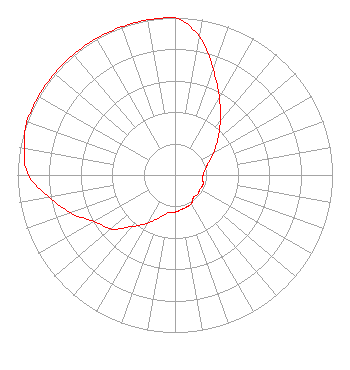
Directional Antenna
Antenna Make/Model: Shivley 6810
Antenna ID: 109775
Polarization:
| Primary Station |
| WDRU(AM) |
Ch. 0 | Creedmoor, North Carolina |
|
Structure Information
Structure Registration Number 1005705
[ASR Heights Differ from W288BU Application]
Structure Type: GTOWER
Registered To:
SBA GC Towers, LLC
Structure Address:
503 Junction Road (nc15958-a #2)
Durham, NC
County Name: Durham County
ASR Issued: 06/06/2014
Date Built: 06/27/1994
Site Elevation: 109.1 m (358 ft.)
Structure Height: 122.2 m (401 ft.)
Height Overall: 127.1 m (417 ft.)
Overall Height AMSL: 236.2 m (775 ft.)
FAA Determination: 05/30/2014
FAA Study #: 2014-ASO-4797-OE
FAA Circular #: 70/7460-1K
Paint & Light FAA Chapters: 3, 4, 6, 12
Removed expiration date from determination. Scenario 1./jjs/case#635066
35-59-55.0 N 78-51-21.0 W (NAD 83)
35-59-54.5 N 78-51-22.0 W
(Converted to NAD 27)
|
W288BU(FX) Licensee Information
Truth Broadcasting Corporation
4405 Providence Lane
Suite D
Winston-Salem, NC 27106
Phone: 336-759-0363
Corporation | 20150403AAM Applicant Information
Stuart W. Epperson, Jr.
Date: 04/03/2015
Application Certifier
Truth Broadcasting Corporation
4405 Providence Lane
Suite D
Winston-Salem, NC 27106
Applicant
Carl E. Gluck
Carl T. Jones Corp
7901 Yarnwood Court
Springfield, VA 22153-2899
Technical Consultant
Davina Sashkin, Esq.
Fletcher, Heald & Hildreth, PLC
1300 North 17th Street
11th Floor
Arlington, VA 22209
|