Accept
By using FCCInfo you agree to the terms & conditions. Read disclaimer Read privacy statement
FCCInfo.com

A Service of Cavell, Mertz & Associates, Inc.
(855) FCC-INFO

K22JN-D
Call Sign History
K22JN-D from 12/08/2009
Channel 22DT

Grand Junction, CO
License
CP
Application
Allocation
STA


K22JN-D Service: LD - Digital TV Translator or LPTV Station
Channel: 22 Zone:
Grand Junction, Colorado
DTV TSID: 8697
Facility ID: 182118
FRN: 0003785466

Status: LIC
Application Accepted: 12/05/2012
License Expires: 04/01/2030
File Number: BLDTL-20121205ABT
Prefix Type: This is BLDTL

FCC Website Links:
  LMS Facility Details
  This Application
  Other K22JN-D Applications
  Including Superseded Applications
  Service Contour - Open Street Map or USGS Map (51 dBu)
  Service Contour - KML / Google Earth (51 dBu)
  Rabbit Ears Info Search for K22JN-D

Site Location: 39-03-59.3 N 108-44-43.3 W (NAD 83)
Site Location: 39-03-59.4 N 108-44-40.9 W (Converted to NAD 27)

ERP: 4 kW
Electrical Beam Tilt: 2 degrees
R/C AGL: 37 m (121 ft.)
R/C AMSL: 2192 m (7192 ft.)
Emission Mask: Stringent

Site Elevation: 2155 m. (7070 ft.)
Height Overall*: 105.2 m (345 ft.)
(* As Filed In This Application, may differ from ASR Data, Below.)
Directional Antenna - Antenna Make/Model: Propagation System Inc PSILP8BA-22
Antenna ID: 111000

Antenna Data for Antenna Id: 111000
K22JN-D LD File: BLDTL-20121205ABT
Propagation System Inc - PSILP8BA-22
Service: LD
Standard Pattern: Y
Pattern and Field Values Include a 50° Clockwise Rotation
AzimuthRatioAzimuthRatioAzimuthRatioAzimuthRatio
00.940100.930200.930300.960
400.980501.000600.980700.960
800.930900.9301000.9401100.970
1200.9901300.9801400.9501500.870
1600.7701700.6301800.4701900.350
2000.2302100.2102200.2202300.230
2400.2202500.2102600.2302700.350
2800.4702900.6303000.7703100.870
3200.9503300.9803400.9903500.970
Structure Information

Structure Registration Number 1226999

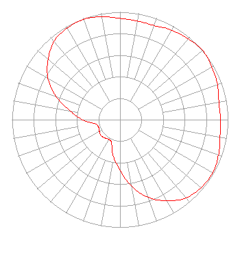
Structure Type: TOWER
Registered To:
MBC GRAND BROADCASTING INC
Structure Address:
Black Ridge Communications Site 8.7 Miles South Of
Fruita, CO
County Name: Mesa County
ASR Issued: 05/03/2013
Date Built: 07/12/2002
Site Elevation: 2155 m (7070 ft.)
Structure Height: 104.7 m (344 ft.)
Height Overall: 105.2 m (345 ft.)
Overall Height AMSL: 2260.2 m (7415 ft.)
FAA Determination: 02/13/2002
FAA Study #: 01-ANM-3788-OE
FAA Circular #: 70/7460-1K
Paint & Light FAA Chapters: 3, 4, 5, 12
PRIOR STUDY 01-ANM-1244-OE
39-03-59.3 N 108-44-43.3 W (NAD 83)
39-03-59.4 N 108-44-40.9 W
(Converted to NAD 27)
K22JN-D Licensee Information

MBC Grand Broadcasting, Inc.
1360 E. Sherwood Drive
Grand Junction, CO 81501
Phone: 970-254-2112
Applicant
20121205ABT Applicant Information

David G. Hinson
Date: 12/05/2012
Application Certifier
MBC Grand Broadcasting, Inc.
1360 E. Sherwood Drive
Grand Junction, CO 81501
Applicant
Larry H. Will P.E.
1055 Powderhorn Drive
Glen Mills, PA 19342-9504
Consulting Engineer
Melodie A. Virtue, Esq.
Garvey Schubert Barer

Associated Land Mobile Licenses


(No Records Found)
Associated Microwave Licenses


(No Records Found)

Study Date: 4/01/2025; Study Duration: 0.0716 Seconds.
Database Sources:
04/01/2025 FCC LMS,
4/1/2025 FCC ASR,
4/1/2025 FCC ULS Microwave, and
4/1/2025 FCC ULS Broadcast Land Mobile.


© 2025 Capitol Airspace Group, LLC.
Alexandria, Virginia


If you have questions or concerns about the station above please contact the station Licensee.
Comments and questions about FCCInfo can be emailed to: webmaster@fccinfo.com