
FCCInfo.com
A Service of Cavell, Mertz & Associates, Inc.
(855) FCC-INFO
|
|
W266CJ from 11/09/2016 W266CJ from 12/30/2013 |
|
|
||||||||||||||||
|
|
W266CJ Channel: 266D 101.1 MHz Beachwood, Ohio Service: FX - A translator or application for a translator. Facility ID: 144180 Fac. Service: FX Programming Delivery Method: Unspecified Status: License Application Accepted: 07/02/2018 Application Granted: 07/09/2018 File Number: BLFT-20180702ABN License Expires: 00/00/0000 Prefix Type: This is a license for a translator Application Type: License To Cover FCC Website Links: LMS Facility Details This Application CDBS Application Other W266CJ Applications Other W266CJ Applications in CDBS Including Superseded Applications Mailing Address Correspondence for W266CJ Correspondence related to application BLFT-20180702ABN Service Contour - Open Street Map or USGS Map (60 dBu) Service Contour - KML / Google Earth (60 dBu) Class: D, A Noncommercial educational operating with no more than 10W Site Location: 41-26-32.2 N 81-29-28.4 W (NAD 83) Site Location: 41-26-32.0 N 81-29-29.0 W (Converted to NAD 27) Effective Radiated Power: 0 kW Horiz. ; 0.25 kW Vert. Transmitter Output Power: 0.104 kW Antenna Center HAAT: 0 m Antenna Center AMSL: 0 m Horiz.; 418 m Vert. Antenna Center HAG: 0 m Horiz.; 71 m Vert. Site Elevation: 347 m. (1138 ft.) Height Overall*: 153 m (502 ft.) (* As Filed In This Application, may differ from ASR Data, Below.) Directional Antenna Antenna Make/Model: None Antenna ID: 16151 Polarization:
| ||||||||||||||||||
| Antenna Data for Antenna Id: 16151 W266CJ FX File: BLFT-20180702ABN None - Service: FX | 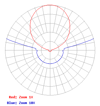 | ||||||||||||||||||
| Azimuth | Ratio | Azimuth | Ratio | Azimuth | Ratio | Azimuth | Ratio | ||||||||||||
| 0 | 1.000 | 10 | 0.980 | 20 | 0.916 | 30 | 0.817 | ||||||||||||
| 40 | 0.690 | 50 | 0.544 | 60 | 0.390 | 70 | 0.190 | ||||||||||||
| 80 | 0.050 | 90 | 0.030 | 100 | 0.030 | 110 | 0.030 | ||||||||||||
| 120 | 0.030 | 130 | 0.030 | 140 | 0.030 | 150 | 0.030 | ||||||||||||
| 160 | 0.030 | 170 | 0.030 | 180 | 0.030 | 190 | 0.030 | ||||||||||||
| 200 | 0.030 | 210 | 0.030 | 220 | 0.030 | 230 | 0.030 | ||||||||||||
| 240 | 0.030 | 250 | 0.030 | 260 | 0.030 | 270 | 0.030 | ||||||||||||
| 280 | 0.050 | 290 | 0.190 | 300 | 0.390 | 310 | 0.544 | ||||||||||||
| 320 | 0.690 | 330 | 0.817 | 340 | 0.916 | 350 | 0.980 | ||||||||||||
Structure Registration Number 1014708 Structure Type: LTOWER Registered To: American Towers LLC Structure Address: 26501 Renaissance Pky (075037 / Cleveland (wclv)) Cleveland, OH County Name: Cuyahoga County ASR Issued: 10/13/2022 Date Built: 09/25/1990 Site Elevation: 346.9 m (1138 ft.) Structure Height: 137.8 m (452 ft.) Height Overall: 153 m (502 ft.) Overall Height AMSL: 499.9 m (1640 ft.) FAA Determination: 10/06/2022 FAA Study #: 2021-AGL-30697-OE Paint & Light FAA Chapters: A2, H PRIOR STUDY 2013-AGL-5223-OE 41-26-32.4 N 81-29-28.1 W (NAD 83) 41-26-32.2 N 81-29-28.7 W (Converted to NAD 27) |
5700 West Oaks Blvd. Rocklin, CA 95765 Phone: 916-251-1600 | Date: 07/02/2018 Application Certifier EDUCATIONAL MEDIA FOUNDATION 5700 West Oaks Blvd Rocklin, CA 95765 Applicant STEPHEN WILDE 5700 West Oaks Blvd Rocklin, CA 95765 CONSULTING ENGINEER MARY O'CONNOR Educational Media Foundation 1800 M Street, N.w. Suite 800n Washington, DC 20036 | |||||||||||||||||