
FCCInfo.com
A Service of Cavell, Mertz & Associates, Inc.
(855) FCC-INFO
|
|
W269DX from 03/04/2020 W269DX from 06/07/2012 W269DX from 05/26/2000 |
|
|
||||||||||||||||
|
|
W269DX Channel: 269D 101.7 MHz Williamsport, Pennsylvania Service: FX - A translator or application for a translator. Facility ID: 106674 Fac. Service: FX Programming Delivery Method: Unspecified Status: License Application Accepted: 09/22/2021 Application Granted: 10/15/2021 File Number: -0000160041 License Expires: 08/01/2022 Application Type: License To Cover FCC Website Links: LMS Facility Details This Application Other W269DX Applications Other W269DX Applications in CDBS Including Superseded Applications Mailing Address Correspondence for W269DX Correspondence related to application -0000160041 Service Contour - Open Street Map or USGS Map (60 dBu) Service Contour - KML / Google Earth (60 dBu) Facility Type: FM STATION Class: D, A Noncommercial educational operating with no more than 10W Site Location: 41-13-05.0 N 76-57-26.0 W (NAD 83) Site Location: 41-13-04.7 N 76-57-27.1 W (Converted to NAD 27) Effective Radiated Power: 0.25 kW Transmitter Output Power: 0.04 kW Antenna Center HAAT: 0 m Antenna Center AMSL: 649 m (2129 ft.) Antenna Center HAG: 85.1 m (279 ft.) Site Elevation: 563.9 m. (1850 ft.) Height Overall*: 91.4 m (300 ft.) (* As Filed In This Application, may differ from ASR Data, Below.) Directional Antenna Antenna Make/Model: BEXT LOG-R Antenna ID: 106735 Polarization: H
| ||||||||||||||||||
| Antenna Data for Antenna Id: 106735 W269DX FX File: -0000160041 BEXT - LOG-R Service: FX | 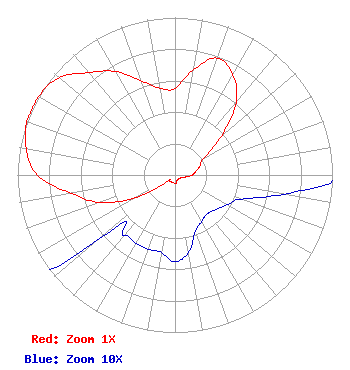 | ||||||||||||||||||
| Azimuth | Ratio | Azimuth | Ratio | Azimuth | Ratio | Azimuth | Ratio | ||||||||||||
| 0 | 0.550 | 10 | 0.680 | 20 | 0.790 | 30 | 0.735 | ||||||||||||
| 40 | 0.605 | 50 | 0.385 | 60 | 0.210 | 70 | 0.170 | ||||||||||||
| 80 | 0.135 | 90 | 0.110 | 100 | 0.070 | 110 | 0.045 | ||||||||||||
| 120 | 0.038 | 130 | 0.034 | 140 | 0.032 | 150 | 0.034 | ||||||||||||
| 160 | 0.038 | 170 | 0.050 | 180 | 0.055 | 190 | 0.050 | ||||||||||||
| 200 | 0.050 | 210 | 0.050 | 220 | 0.050 | 230 | 0.065 | ||||||||||||
| 240 | 0.285 | 250 | 0.510 | 260 | 0.670 | 270 | 0.875 | ||||||||||||
| 280 | 0.960 | 290 | 1.000 | 295 | 1.000 | 300 | 1.000 | ||||||||||||
| 310 | 0.960 | 320 | 0.850 | 330 | 0.760 | 340 | 0.640 | ||||||||||||
| 350 | 0.560 | ||||||||||||||||||
Structure Registration Number 1025012 Structure Type: TOWER Registered To: Backyard Broadcasting of Pennsylvania Structure Address: Walton Remote Montoursville, PA County Name: Lycoming County ASR Issued: 07/01/2021 Date Built: 08/13/1993 Site Elevation: 563.9 m (1850 ft.) Structure Height: 91.4 m (300 ft.) Height Overall: 91.4 m (300 ft.) Overall Height AMSL: 655.3 m (2150 ft.) FAA Determination: 12/12/2008 FAA Study #: 2008-AEA-4572-OE Paint & Light FAA Chapters: A1, H PRIOR STUDY 1993-AEA-1261-OE 41-13-05.0 N 76-57-26.0 W (NAD 83) 41-13-04.7 N 76-57-27.1 W (Converted to NAD 27) |
4537 Muncy Exchange Rd Turbotville, PA 17772 Phone: 570-412-6295 Limited Liability Company | Title: Sole Member Date: 09/22/2021 Application Certifier BACKYARD BROADCASTING OF PENNSYLVANIA LLC Backyard Broadcasting Of Pennsylvania Llc 4537 Muncy Exchange Rd Turbotville, PA 17772 Applicant Van A Michael Backyard Broadcasting Of Pennsylvania Llc 4537 Muncy Exchange Rd Turbotville, PA 17772 Sole Member Victor A Michael, Jr. Michael Radio Company, Llc 1418 Bradley Avenue Cheyenne, WY 82001 Technical Consultant | |||||||||||||||||
| |||||||||||||||||||