Accept
By using FCCInfo you agree to the terms & conditions. Read disclaimer Read privacy statement
FCCInfo.com

A Service of Cavell, Mertz & Associates, Inc.
(855) FCC-INFO

WWNJ(FM)
Call Sign History
WWNJ from 11/12/1991
WWNJ from 03/13/1987
91.1 MHz

Toms River Township, NJ
License
CP
Application
Allocation
STA


WWNJ Channel: 216A 91.1 MHz
Toms River Township, New Jersey
Service: FM - A full-service FM station or application.
Facility ID: 41203
Fac. Service: FM Analog & Digital

Status: License
Application Accepted: 09/26/2012
Application Granted: 10/16/2012
File Number: BLED-20120926AIX
License Expires: 00/00/0000
Prefix Type: This is a license for a noncommercial educational FM station
Application Type: Amendment

FCC Website Links:
  LMS Facility Details
  This Application
  CDBS Application
  Other WWNJ Applications
  Other WWNJ Applications in CDBS
  Including Superseded Applications
  Mailing Address
  Correspondence for WWNJ
  Correspondence related to application BLED-20120926AIX
  Service Contour - Open Street Map or USGS Map (60 dBu)
  Service Contour - KML / Google Earth (60 dBu)
  Public Inspection Files

Facility Type: NON-COMMERCIAL EDUC. FM
Class: A, A Zone I; I-A; or II station; with 0.1kW-6kW ERP and a class contour distance <=28km

Site Location: 39-59-49.0 N 74-10-21.0 W (NAD 83)
Site Location: 39-59-48.6 N 74-10-22.5 W (Converted to NAD 27)

Effective Radiated Power: 5.8 kW
Transmitter Output Power: 2.09 kW
Antenna Center HAAT: 97 m (318 ft.)
Antenna Center AMSL: 105.7 m (347 ft.)
Antenna Center HAG: 87.5 m (287 ft.)

Calculated Site Elevation: 18.2 m. (60 ft.)
Height Overall*: 94.4 m (310 ft.)
(* As Filed In This Application, may differ from ASR Data, Below.)
Directional Antenna
Antenna Make/Model: Systems With Reliability Inc. FMI3D/4-DA
Antenna ID: 110562
Polarization:

Antenna Data for Antenna Id: 110562
WWNJ FM File: BLED-20120926AIX
Systems With Reliability Inc. - FMI3D/4-DA
Service: FM
AzimuthRatioAzimuthRatioAzimuthRatioAzimuthRatio
00.178100.178200.190300.220
400.275500.346600.436700.549
800.691900.870971.0001001.000
1101.0001201.0001301.0001401.000
1501.0001601.0001701.0001801.000
1851.0001900.9042000.7182100.570
2200.4532300.3602400.2862500.238
2600.2252700.2222800.2252900.226
3000.2243100.2243200.2243300.224
3400.2113500.178
Structure Information

Structure Registration Number 1044747

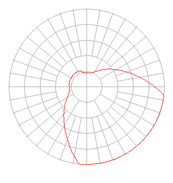
[ASR Heights Differ from WWNJ Application]
Structure Type: GTOWER
Registered To:
CTI Towers Assets III, LLC
Structure Address:
1470 Hooper Ave
Toms River, NJ
County Name: Ocean County
ASR Issued: 01/28/2021
Date Built: 01/01/1974
Site Elevation: 17.4 m (57 ft.)
Structure Height: 94.4 m (310 ft.)
Height Overall: 94.4 m (310 ft.)
Overall Height AMSL: 111.8 m (367 ft.)
FAA Determination: 02/12/2015
FAA Study #: 2015-AEA-619-OE
Paint & Light FAA Chapters: A1, H, 3, 11, 21, 23
PRIOR STUDY 2008-AEA-4724-OE
39-59-51.1 N 74-10-18.9 W (NAD 83)
39-59-50.7 N 74-10-20.4 W
(Converted to NAD 27)
WWNJ(FM) Licensee Information

MERCER COUNTY COMMUNITY COLLEGE
1200 Old Trenton Road
West Windsor, NJ 08550
Phone: 609-570-3727
20120926AIX Applicant Information

PETER FRETWELL
Date: 09/26/2012
Application Certifier
MERCER COUNTY COMMUNITY COLLEGE
1200 Old Trenton Road
West Windsor, NJ 08550
Applicant
KATE ENGLISH
Doug Vernier Telecommunications Consulta
401 Main Street, Suite 213
Cedar Falls, IA 50613
TECHNICAL CONSULTANT
LEE J. PELTZMAN
Shainis & Peltzman, Chartered

Associated Land Mobile Licenses


(No Records Found)
Associated Microwave Licenses


(No Records Found)

Study Date: 3/28/2024; Study Duration: 0.1455 Seconds.
Database Sources: 1/10/2024 FCC CDBS,
03/28/2024 FCC LMS,
3/26/2024 FCC ASR,
3/26/2024 FCC ULS Microwave, and
3/26/2024 FCC ULS Broadcast Land Mobile.


© 2024 Cavell Mertz & Associates, Inc.
Manassas, Virginia


If you have questions or concerns about the station above please contact the station Licensee.
Comments and questions about FCCInfo can be emailed to: webmaster@fccinfo.com