
FCCInfo.com
A Service of Cavell, Mertz & Associates, Inc.
(855) FCC-INFO
|
|
K06QT-D from 03/11/2020 |
|
|
||||||||||||||||
|
|
Status: License Application Accepted: 03/09/2023 License Expires: 08/01/2029 File Number: -0000212317 FCC Website Links: LMS Facility Details This Application Other W06DG-D Applications Including Superseded Applications Mailing Address Correspondence for W06DG-D Correspondence related to application -0000212317 Service Contour - Open Street Map or USGS Map (43 dBu) Service Contour - KML / Google Earth (43 dBu) Rabbit Ears Info Search for W06DG-D Site Location: 37-53-14.2 N 87-31-07.0 W (NAD 83) Site Location: 37-53-14.0 N 87-31-07.0 W (Converted to NAD 27) ERP: 0.1 kW Polarization: Circularly polarized R/C AGL: 6.1 m (20 ft.) R/C AMSL: 158.5 m (520 ft.) Emission Mask: Stringent Site Elevation: 152.4 m. (500 ft.) Height Overall*: 289.3 m (949 ft.) (* As Filed In This Application, may differ from ASR Data, Below.) Directional Antenna - Antenna Make/Model: SAMCO SAM-137 Antenna ID: 1009462 Polarization: Circularly polarized
| ||||||||||||||||||
| Antenna Data for Antenna Id: 1009462 W06DG-D LD File: -0000212317 SAMCO - SAM-137 Service: LD Standard Pattern: Y Pattern and Field Values Include a 90° Clockwise Rotation | 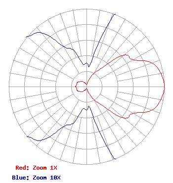 | ||||||||||||||||||
| Azimuth | Ratio | Azimuth | Ratio | Azimuth | Ratio | Azimuth | Ratio | ||||||||||||
| 0 | 0.030 | 10 | 0.030 | 20 | 0.090 | 30 | 0.200 | ||||||||||||
| 40 | 0.320 | 50 | 0.630 | 60 | 0.690 | 70 | 0.890 | ||||||||||||
| 80 | 0.970 | 90 | 1.000 | 100 | 0.970 | 110 | 0.890 | ||||||||||||
| 120 | 0.690 | 130 | 0.630 | 140 | 0.320 | 150 | 0.200 | ||||||||||||
| 160 | 0.090 | 170 | 0.030 | 180 | 0.030 | 190 | 0.030 | ||||||||||||
| 200 | 0.050 | 210 | 0.060 | 220 | 0.090 | 230 | 0.100 | ||||||||||||
| 240 | 0.120 | 250 | 0.130 | 260 | 0.130 | 270 | 0.140 | ||||||||||||
| 280 | 0.130 | 290 | 0.130 | 300 | 0.120 | 310 | 0.100 | ||||||||||||
| 320 | 0.090 | 330 | 0.060 | 340 | 0.050 | 350 | 0.030 | ||||||||||||
Structure Registration Number 1043106 Structure Type: Registered To: Gray Media Group, Inc. Structure Address: On Wolf Hills 2300' Ne Of Int Of Wathen Ln & Cemetary Rd Henderson, KY County Name: Henderson County ASR Issued: 02/11/2019 Date Built: 05/01/1977 Site Elevation: 152.4 m (500 ft.) Structure Height: 266.1 m (873 ft.) Height Overall: 289.3 m (949 ft.) Overall Height AMSL: 441.7 m (1449 ft.) FAA Determination: 12/08/1975 FAA Study #: 75-SO-1761-OE Paint & Light FAA Chapters: 1, 3, 7, 16, 21 RED LIGHTS/PAINT 37-53-14.2 N 87-31-07.0 W (NAD 83) 37-53-14.0 N 87-31-07.0 W (Converted to NAD 27) |
14 Tuxedo Drive Beaufort, SC 29907 Phone: 717-226-3535 Limited Liability Company | Title: Manager Date: 03/09/2023 Application Certifier Lowcountry 34 Media, Llc 14 Tuxedo Drive Beaufort, SC 29907 Applicant Darryl K DeLawder Delawder Communications, Inc. P. O. Box 1095 Ashburn, VA 20146 President Davina Sashkin Wilkinson Barker Knauer, Llp 1800 M Street, Nw Suite 800n Washington, DC 20036 | |||||||||||||||||