
FCCInfo.com
A Service of Cavell, Mertz & Associates, Inc.
(855) FCC-INFO
|
|
|
|
|
|||||||||||||||||
|
|
Status: License Application Accepted: 09/21/2023 License Expires: 12/01/2028 File Number: -0000221196 FCC Website Links: LMS Facility Details This Application Other W25FQ-D Applications Including Superseded Applications Mailing Address Correspondence for W25FQ-D Correspondence related to application -0000221196 Service Contour - Open Street Map or USGS Map (51 dBu) Service Contour - KML / Google Earth (51 dBu) Rabbit Ears Info Search for W25FQ-D Site Location: 34-10-51.0 N 79-23-51.0 W (NAD 83) Site Location: 34-10-50.4 N 79-23-51.8 W (Converted to NAD 27) ERP: 15 kW Polarization: Elliptically polarized Electrical Beam Tilt: 1 degree R/C AGL: 73.2 m (240 ft.) R/C AMSL: 95.5 m (313 ft.) Emission Mask: Full Service Site Elevation: 22.3 m. (73 ft.) Height Overall*: 96.9 m (318 ft.) (* As Filed In This Application, may differ from ASR Data, Below.) Directional Antenna - Antenna Make/Model: Dielectric DLP-12M/VP (AER) Antenna ID: 1010864 Polarization: Elliptically polarized
| |||||||||||||||||||
| Antenna Data for Antenna Id: 1010864 W25FQ-D LD File: -0000221196 Dielectric - DLP-12M/VP (AER) Service: LD Standard Pattern: Y Pattern and Field Values Include a 10° Clockwise Rotation | 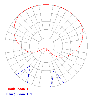 | |||||||||||||||||||
| Azimuth | Ratio | Azimuth | Ratio | Azimuth | Ratio | Azimuth | Ratio | |||||||||||||
| 0 | 1.000 | 10 | 1.000 | 20 | 1.000 | 30 | 1.000 | |||||||||||||
| 40 | 1.000 | 50 | 1.000 | 60 | 0.988 | 70 | 0.946 | |||||||||||||
| 80 | 0.886 | 90 | 0.815 | 100 | 0.725 | 110 | 0.624 | |||||||||||||
| 120 | 0.529 | 130 | 0.428 | 140 | 0.293 | 150 | 0.146 | |||||||||||||
| 160 | 0.067 | 170 | 0.085 | 180 | 0.136 | 190 | 0.147 | |||||||||||||
| 200 | 0.136 | 210 | 0.085 | 220 | 0.067 | 230 | 0.146 | |||||||||||||
| 240 | 0.293 | 250 | 0.428 | 260 | 0.529 | 270 | 0.624 | |||||||||||||
| 280 | 0.725 | 290 | 0.815 | 300 | 0.886 | 310 | 0.946 | |||||||||||||
| 320 | 0.988 | 330 | 1.000 | 340 | 1.000 | 350 | 1.000 | |||||||||||||
Structure Registration Number 1044904 Structure Type: TOWER Registered To: Subcarrier Communications Inc Structure Address: Pine At Harlee Sts Marion, SC County Name: Marion County ASR Issued: 01/10/2006 Date Built: 01/01/1962 Site Elevation: 22.3 m (73 ft.) Structure Height: 85.3 m (280 ft.) Height Overall: 96.9 m (318 ft.) Overall Height AMSL: 119.2 m (391 ft.) FAA Determination: 07/21/1998 FAA Study #: 98-ASO-4946-OE FAA Circular #: 70/7460-1J Paint & Light FAA Chapters: 4, 6, 13 PREVIOUS FAA 96-ASO-0411-OE 34-10-51.0 N 79-23-51.0 W (NAD 83) 34-10-50.4 N 79-23-51.8 W (Converted to NAD 27) |
38955 Hills Tech Dr. Farmington Hills, MI 48331 Phone: 248-536-0776 Limited Liability Company | Title: Manager Date: 09/21/2023 Application Certifier Lowcountry 34 Media, Llc 14 Tuxedo Drive Beaufort, SC 29907 Applicant Davina Sashkin, Esq Wilkinson Barker Knauer Llp 1800 M Street Nw Suite 800n Washington, DC 20036 Partner | ||||||||||||||||||