|
W264BT Channel: 264D 100.7 MHz
Edison, New Jersey
Service: FX - A translator or application for a translator.
Facility ID: 143711
FRN: 0020859898
Fac. Service: FX
Programming Delivery Method: Unspecified
Status: LIC
Application Accepted: 08/21/2013
Application Granted: 09/25/2013
File Number: BLFT-20130821ADH
License Expires: 06/01/2030
Prefix Type: This is a license for a translator
Application Type: License To Cover
FCC Website Links:
LMS Facility Details
This Application
Other W264BT Applications
Including Superseded Applications
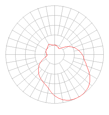
Service Contour - Open Street Map or USGS Map (60 dBu)
Service Contour - KML / Google Earth (60 dBu)
Class: D, A Noncommercial educational operating with no more than 10W
Site Location: 40-31-45.5 N 74-23-32.3 W (NAD 83)
Site Location: 40-31-45.1 N 74-23-33.8 W (Converted to NAD 27)
Effective Radiated Power: 0.2 kW
Transmitter Output Power: 0.075 kW
Antenna Center AMSL: 99 m (325 ft.)
Antenna Center HAG: 66 m (217 ft.)
Site Elevation: 33 m. (108 ft.)
Height Overall*: 79 m (259 ft.)
(* As Filed In This Application, may differ from ASR Data, Below.)
Directional Antenna
Antenna Make/Model: None
Antenna ID: 111840
Polarization:
| Primary Station |
| WKMB(AM) |
Ch. 0 | Stirling, New Jersey |
|
Structure Information
Structure Registration Number 1045848
[ASR Heights Differ from W264BT Application]
Structure Type: GTOWER
Registered To:
American Towers LLC
Structure Address:
80 Talmadge Road (000054 /edison Nj)
Edison, NJ
County Name: Middlesex County
ASR Issued: 08/13/2014
Date Built: 05/03/2004
Site Elevation: 32.9 m (108 ft.)
Structure Height: 76.8 m (252 ft.)
Height Overall: 82.3 m (270 ft.)
Overall Height AMSL: 115.2 m (378 ft.)
FAA Determination: 07/28/2014
FAA Study #: 2014-AEA-4388-OE
FAA Circular #: 70/7460-1K
Paint & Light FAA Chapters: 4, 8, 12
PRIOR STUDY 2013-AEA-5523-OE
40-31-45.5 N 74-23-32.3 W (NAD 83)
40-31-45.1 N 74-23-33.8 W
(Converted to NAD 27)
|
W264BT(FX) Licensee Information
Rahul Walia
16 Barbieri Court
Princeton, NJ 08540
Phone: 732-616-2309
| 20130821ADH Applicant Information
Rahul Walia
Date: 08/21/2013
Application Certifier
Rahul Walia
16 Barbieri Court
Princeton, NJ 08540
Applicant
Edward A. Schober
PO Box 367
Haddon Heights, NJ 08035
Consulting Engineer
Edward A. Schober
Radiotechniques Engineering, LLC
Box 367
Haddon Heights, NJ 08035
|